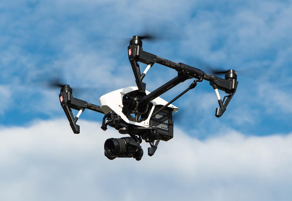
Drone pilot jobs are commercial positions where certified FAA Part 107 pilots fly drones for industries including construction, real estate, energy, public safety, agriculture, and filmmaking. Entry-level pilots earn $25 to $45 per hour or $42,000 to $50,000 annually.
Experienced specialists earn $70,000 to $130,000 or more depending on the niche. BVLOS (Beyond Visual Line of Sight) operators and LiDAR mapping specialists command the highest rates.
The most in-demand drone pilot jobs in 2026 are infrastructure inspections, construction mapping, thermal imaging, and public safety operations. Getting started requires an FAA Part 107 certificate ($175 exam fee), which most pilots complete in 2 to 4 weeks of study.
Drone pilot jobs are in high demand across 15 industries in 2026. Entry-level pilots earn $25 to $45 per hour. Experienced specialists in mapping, thermal imaging, and infrastructure inspection earn $70,000 to $130,000 or more annually.
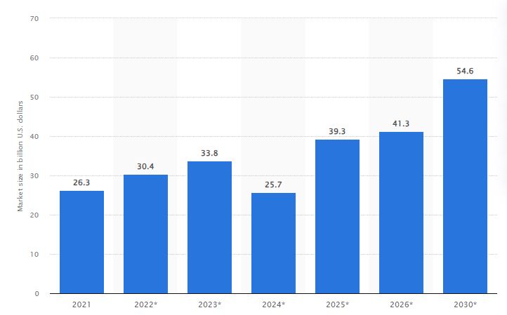
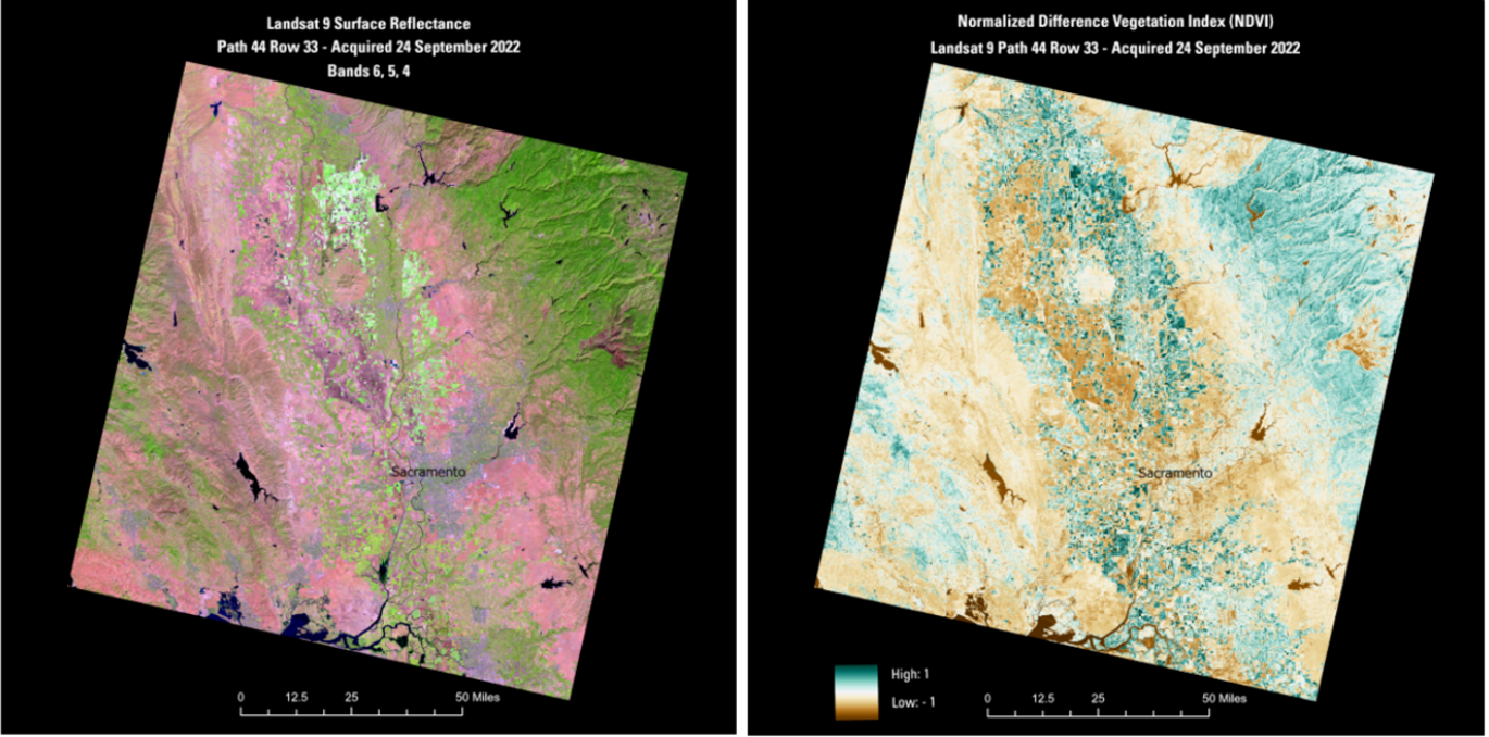
The global drone market is projected to reach $223.66 billion by 2034, according to Fact MR and pilot demand is growing with it.
The Trend of Drone Market Size Worldwide from 2021 to 2030 (Source: Statista)
This growth creates new jobs for both new and experienced drone pilots. More companies are using drones in their day-to-day operations. Many drone pilot jobs in 2026 also support long-term career development, not just one-time gigs.
Industries now depend on drones for inspections, mapping, surveying, thermal imaging, and real-time monitoring. This creates a steady demand for skilled UAV operators.
In this article, we’ll talk about the most promising drone operator jobs available in 2026. We’ll also explore how you can take the first step toward landing your dream job.
To understand these opportunities better, let’s start with the basics.
What Does a Drone Pilot Do?
Imagine a drone pilot as the captain of a tiny flying machine. Their job is to make sure the drone takes off safely, flies smoothly, and lands without any issues.
Here’s what a drone pilot typically does:
1. Fly Safe
Drone pilots follow safety steps before every flight. They check the drone, inspect the battery, and make sure all systems are working.
They also plan their flight path, avoid obstacles, and stay aware of their surroundings, especially other aircraft.
During the mission, they follow drone laws and avoid people, property, andrestricted zones.
A drone pilot’s main focus is simple: fly safely from takeoff to landing.
2. Capture Photos, Videos, or Data
Many drone pilots use their skills to capture amazing visuals or technical data. This could range from stunning aerial shots for movies to capturing mapping or inspection data.
Think of drone pilots as flying photographers, videographers, or data collectors, depending on the job. Drones are often used to take amazing pictures and videos from up high.
3. Plan Every Mission
Drone missions need planning. Pilots check the weather, study airspace restrictions, and choose the best flight route. They also confirm permissions, prepare equipment, and make sure all safety steps are in place.
Good planning ensures smooth and efficient missions.
So, where can you find drone pilots buzzing around? They work across many industries, including:
Each job requires different skills, but they all rely on safe and accurate drone operation.
Before you take on real-world jobs, getting the proper training to fly these machines safely and legally is important. Training programs teach you flight basics, safety habits, and hands-on skills that go beyond what’s required for the Part 107 test.
Bonus Tip: Before starting your entry-level drone pilot career, consider taking the New Pilot Bundle. This training covers safe flight operations and helps you prepare for your Part 107 certification.
In the United States, this is regulated by the Federal Aviation Administration (FAA) under the Part 107 Small Unmanned Aircraft System (sUAS) Rule. This license shows that you understand airspace rules and can operate a drone safely and responsibly.
Eligibility:
To qualify for a Part 107 license, you must:
Be at least 16 years old.
Pass a background check.
Be able to read, speak, understand, and write English fluently.
Testing Process:
You’ll need to pass an aeronautical knowledge exam at an FAA-approved testing center.
The test covers airspace classifications, drone regulations, weather, safety, and emergency procedures.
You can study using resources available from the FAA website and various third-party sources.
Once you have your Part 107 certificate, these are the main places pilots find paid work:
Platform
Best For
Notes
DroneBase
Freelance gigs for real estate and inspections
Good for first 10-20 jobs; rates are below direct client rates
FlyGuys
Network-matched missions nationwide
Free to join; requires Part 107 and your own equipment
Thumbtack
Local freelance clients
Good for real estate and events
Indeed / LinkedIn
Full-time employed positions
Search “drone pilot” or “UAV operator”
AirWorks
Enterprise and inspection contracts
Higher-paying, requires demonstrated experience
Direct outreach
Construction firms, utilities, insurers
Always pays more than platform-mediated work
Note: Freelance platforms like DroneBase are useful for building early experience but pay below market rate. Direct client relationships always pay more. Start with platforms to build your portfolio, then transition to direct outreach.
With those platforms in mind, here is how the work you pick early shapes your career over time.
How Drone Pilot Jobs Support Career Growth in 2026
Most new pilots start with simple missions to build flight experience.
As you learn mapping skills, inspection workflows, and industry software, you can move into more advanced roles. These skills open doors in:
Insurance inspections
Energy and utility monitoring
Construction and mining surveys
Public safety and emergency response
This early experience forms the foundation of a strong, long-term drone pilot career.
The Highest-Paying Opportunity in 2026: BVLOS Operations
Beyond Visual Line of Sight (BVLOS) operations are the fastest-growing and highest-paying area of drone work. Pilots with BVLOS experience and certification command salaries above $100,000 in sectors like energy infrastructure, precision agriculture, and package delivery logistics. The FAA’s Part 108 BVLOS framework is expected to open more routine operations in 2026, creating new demand for certified BVLOS operators before the market becomes crowded.
Now, let’s unfold the markets and industries where drone pilots are in high demand.
Drone Pilot Jobs: Understanding The Demand
Drone pilots can choose from a wide range of job roles in 2026. Each industry uses drones differently, so the tasks and required skills vary.
Here are the top opportunities:
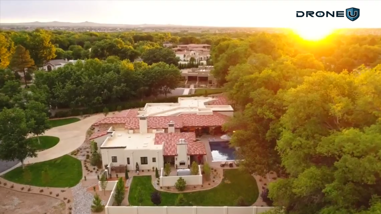
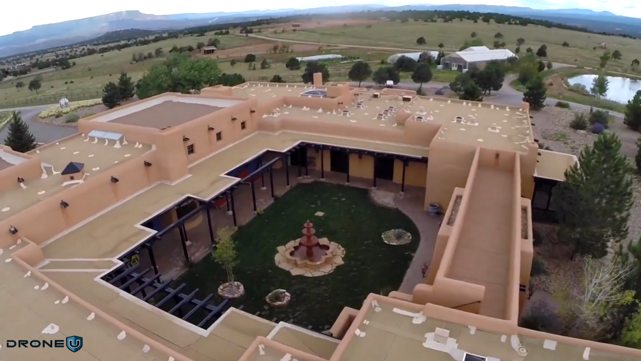
1. Drone Jobs in Real Estate
Real estate is undoubtedly one of the most prevalent industries that hires drone pilots. The primary goal is to work with realtors who represent and sell high-end properties.
Using drones for aerial photography and videography is an effective way to market properties, and it can give listings an edge over the competition.
Real estate agents and property owners are always looking for fresh ways to showcase their properties, and that’s where you, the real estate drone pilot, come in.
Your job as a real estate drone pilot is to capture aerial stills and videos of a property for sale, which the real estate agent will use in marketing and promotion.
To get drone flying jobs in real estate, you must have the skills to capture smooth videos and incredible photos from your eyes in the sky. Once you acquire the right skills, you can offer your services to clients and help market their properties effectively.
Merits and Demerits of Choosing the Real Estate Industry
Being a drone pilot in real estate can be exciting and profitable because there’s a lot of demand and cool technology. However, it also comes with its share of challenges.
Merits
Demerits
1. High demand for aerial footage and photography in real estate marketing.
1. Stringent regulations and licensing requirements for drone operation.
2. Flexible work schedule and potential for freelance opportunities.
2. Weather conditions can limit flight operations and affect productivity.
3. Ability to capture unique perspectives and showcase properties effectively.
3. Initial investment in high-quality drones and equipment can be expensive.
4. Opportunity to work outdoors and explore various properties and locations.
4. Competition from other drone pilots and aerial photography services.
Versatility of Drone Work in Real Estate
There is a wide range of missions that UAV pilots typically fly, such as:
Property listings
Complexes and shopping centers
Various resort facilities
Golf courses
Real estate drone operators enjoy incredible versatility, and drone pilots have a wide array of opportunities to work on different projects. In addition to providing flexibility, these positions provide the invaluable experience required for success.
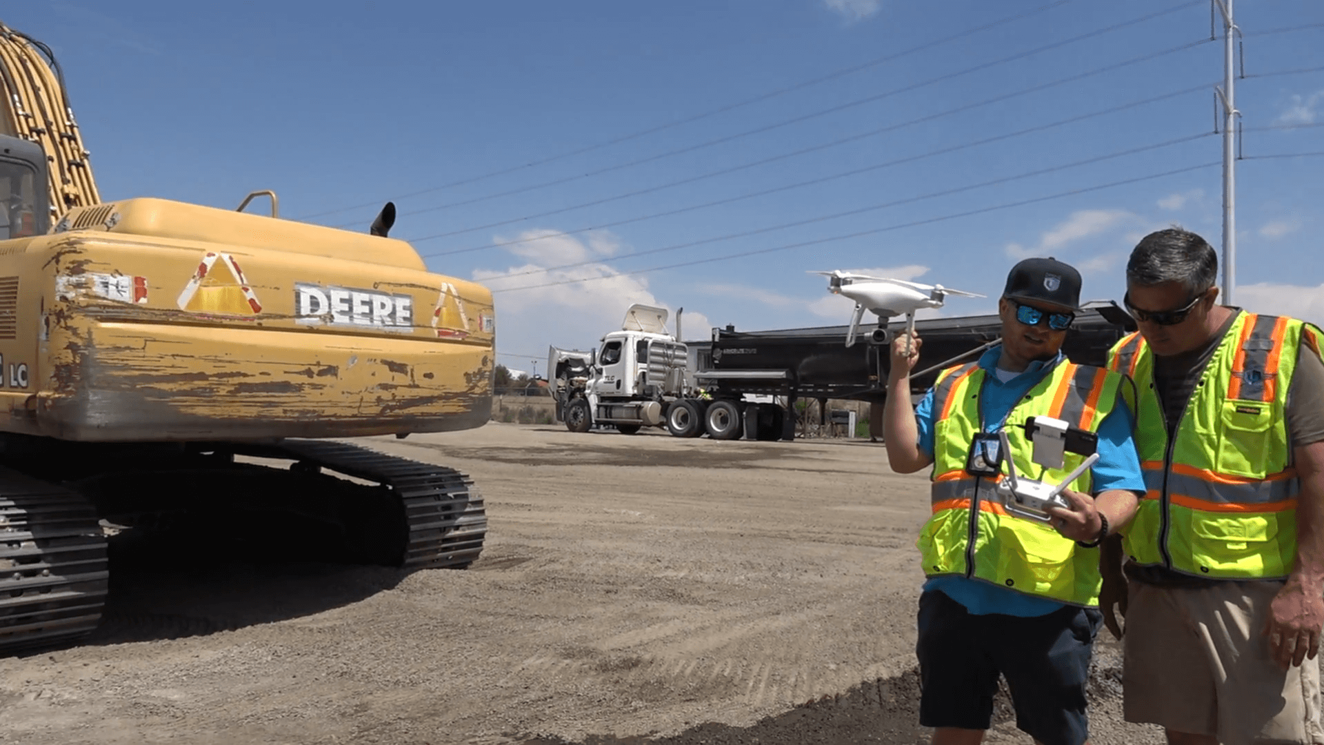
2. Drone Jobs in Construction
Construction is one of the fastest-growing commercial drone industries, with the use of drones increasing exponentially over the last few years.
According to Fact.MR, the construction drone market is anticipated to exhibit a compound annual growth rate (CAGR) of 23.4%, reaching a market value of US$ 14.28 billion by the end of 2035.
A typical commercial construction project runs 20 months behind schedule, and it costs nearly 80%.
Drone pilots save construction companies money by running surveys at every stage of a project. These surveys cover a wide range, including:
Precise measurement and location of stockpiles: Drones capture accurate data on material volumes and locations, reducing the need for manual surveys and potential errors.
Real-time progress monitoring in remote areas: From mountains to deserts, drones offer a safe and efficient way to track construction progress in hard-to-reach areas.
Enhanced safety assessments: Drones can inspect dangerous or difficult-to-access areas, identifying potential hazards and keeping workers safe.
This boom in the construction industry has opened up some really interesting opportunities to join UAV operators, such as
1. Site Selection: You can fly to a prospective site for the most updated view of the property and help with site selection and planning.
2. Zoning Meetings: Zoning meetings can be time-consuming and often lead to delays. By using drone data, you can share accurate visuals with the zoning board and speed up the approval process.
3. Legal Protection and Documentation: You can document road conditions by creating a map or recording a quick aerial video. This gives the construction team a clear view of the site before trucks and heavy equipment arrive, helping them plan more efficiently.
4. Construction Monitoring and Management: Construction contractors can access high-resolution, up-to-date maps of their job sites. This helps them monitor progress more accurately and manage the site more effectively.
5. Construction Progression: You can import the latest site plan to your drone map and compare the designs to reality, in both 2D and 3D. This can help construction companies accurately track the real construction progress. It’s also an easy way to keep stakeholders, including investors, updated on how the project is moving along.
A construction firm can survey large areas and track materials and progress using drone data and software.
Additionally, drones play a vital role in project planning, providing aerial data that helps construction companies determine suitable construction zones and potential limitations.
Merits and Demerits of Choosing the Construction Industry
Here’s a breakdown of the merits and demerits for drone pilots operating within the construction industry:
Merits
Demerits
1. Enhanced project monitoring and progress tracking using aerial surveys and inspections.
1. Complex airspace regulations and restrictions near construction sites.
2. Improved safety through remote site monitoring, reducing the need for on-site visits.
2. Initial investment and maintenance costs for high-quality drone equipment.
3. Efficient data collection for site mapping, topography analysis, and 3D modeling.
3. Limited battery life and flight time can impact productivity and data collection.
4. Quick identification of potential issues such as structural defects or safety hazards.
4. Dependence on favorable weather conditions for safe and effective drone operations.
Types of Drone Work in the Construction Industry
UAV pilots working in construction typically fly a variety of different missions, including pre-building site inspections of the earth, possible drainage spots, and other factors to determine the best places to build, dig, or stockpile materials.
These missions require pilots to know regulations and data collection standards.
Whether you’re working for a large company or a small startup, there is plenty of demand for UAV pilot jobs in this industry.
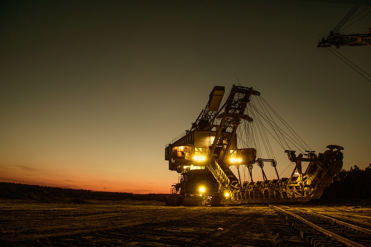
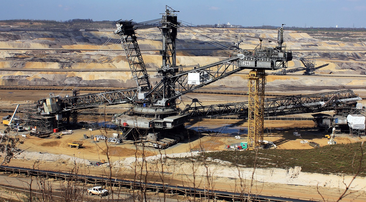
3. Drone Jobs in Mining and Aggregate
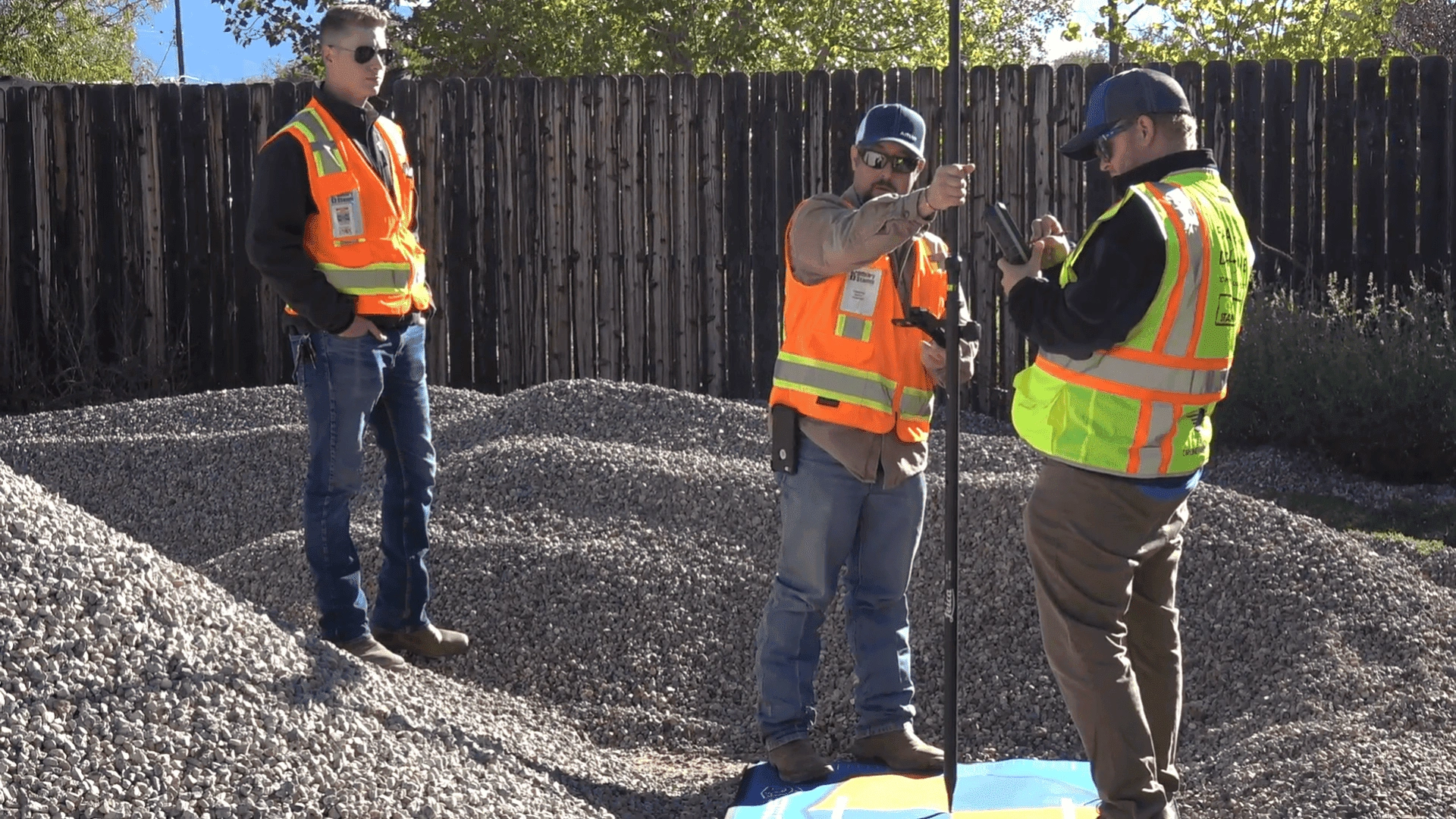
Mining and aggregate companies use drones to survey large sites, measure stockpiles, and monitor progress. These sites are often remote and hazardous, so drones help teams collect data faster and reduce field risk.
Survey teams used to collect this data on foot. The process took hours and exposed workers to heavy machinery and unstable ground. A trained pilot can generate accurate 3D maps that help identify the best areas for digging, hauling, and stockpiling materials.
They can collect the same amount of data in under 20 minutes. Drones also keep personnel out of hazardous areas, reducing safety risks on site.
Merits and Demerits of Choosing the Mining Industry
The mining and aggregates industry offers unique opportunities and challenges for drone pilots. Below are the merits and demerits of working within this sector.
Merits
Demerits
1. You can map and measure large areas much faster and cheaper than before.
1. Flying drones in mines needs special permission.
2. Drones can go into dangerous places instead of people, making it much safer for workers.
2. The tough environment in mines and quarries means you need to spend money on drones that can take high-quality images and not get damaged easily.
3. The information from drones helps mine managers plan better, track materials, and make smarter decisions.
3. Just flying the drone isn’t enough. You need to be good at turning all the photos and measurements into useful information.
4. Drones can check how mining affects the land and help companies follow environmental rules.
4. Mines can be dusty, noisy, and full of stuff that messes with drones. This can make flying tricky and affect the quality of the information you get.
5. Using drones for checks and measuring stuff can be cheaper than traditional methods.
5. High-quality drones are required.
Types of Drone Work in the Mining and Aggregate Industry
UAS operators in mining or aggregates typically fly missions such as site surveys, progress checks, and safety inspections. Progress monitoring is especially important when measuring stockpiles of earth, sand, clay, or other materials.
Common Missions in Mining & Aggregates
Stockpile measurement: Create 3D models to calculate volume, track inventory, and validate contractor reports.
Site surveys: Map large areas for planning, extraction layouts, and haul road designs.
Progress monitoring: Document excavation activity and track material movement over time.
Safety inspections: Capture imagery of slopes, pit walls, and restricted zones without sending workers onsite.
Mining operations run continuously and require frequent surveys, measurements, and compliance reporting. Because these workflows repeat weekly or monthly, they create ongoing demand for trained pilots and GIS specialists rather than one-off project work.
4. Drone Jobs in Filmmaking
Drones have become the buzziest item in the film industry, adding a breath of fresh air to any scene with their unique aerial perspective.
But their appeal goes beyond just cool shots.
Not only are drones considerably more cost-effective than helicopters, but they also offer enhanced versatility. Unlike helicopters, drones don’t require specialized air crews, complex permits, or high insurance costs. They also remove risks associated with piloted aircraft.
Furthermore, opting for drones over helicopters eliminates the risk of potential harm to pilots. As a result, the demand for skilled drone operators in filmmaking continues to rise.
Most film-related drone work is project-based. Production companies typically hire drone pilots to capture specific aerial shots, such as chase scenes, establishing shots, landscape flyovers, or location footage. They usually aren’t hired for the entire duration of a shoot, but they are brought in whenever aerial work is needed.
Drones are now used across many parts of filmmaking, including:
establishing wide shots
following action sequences
capturing aerial perspectives that are unsafe or impossible with ground cameras
collecting location footage or reference material
Merits and Demerits of Choosing the Filmmaking Industry
Drone pilots need to understand these merits and demerits before considering getting into this exciting industry
1. Strict aviation regulations and permits are required for filming with drones, adding logistical challenges.
2. Cost-effective alternative to traditional helicopter shots, reducing production expenses.
2. Limited flight time and battery constraints may necessitate multiple takes and careful planning.
3. Increased flexibility and creativity in shot composition, enabling unique and cinematic visuals.
3. Skill and experience required to operate drones effectively and capture professional-quality footage.
4. Streamlined production process with quick setup and versatility in various filming environments.
4. Potential disruptions due to noise from drone propellers, requiring careful coordination on set.
Types of Drone Work in Film Production
Check out this in-depth video on how you can get work from a big production house like Netflix
UAV pilots can fly on a variety of missions in the film industry. Mission types include
Aerial photography: capturing images or basic video from above
Cinematic shots: artistic and complex camera movements
Action sequence coverage: chase scenes, fight scenes, and fast-moving subjects
As a professional involved in drone operator jobs within the film industry, you need strong flying skills. You also need precise control over camera movement and the ability to adapt to fast-changing shooting environments. When you master these skills, you become a top choice for high-budget productions.
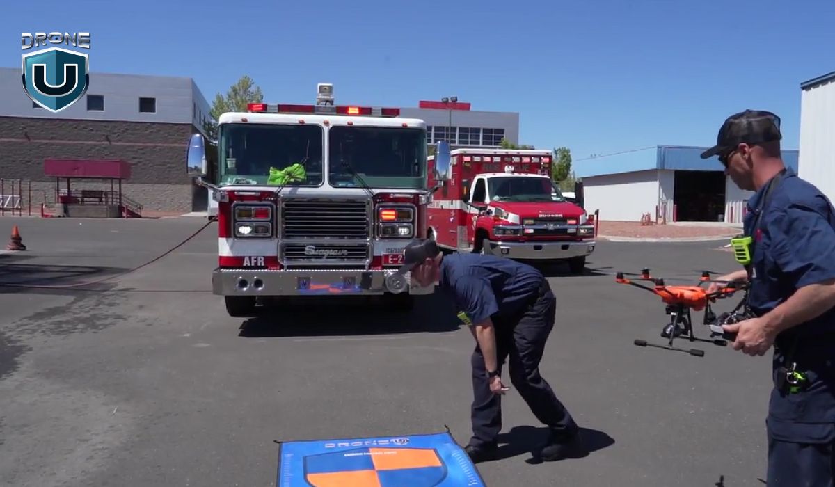
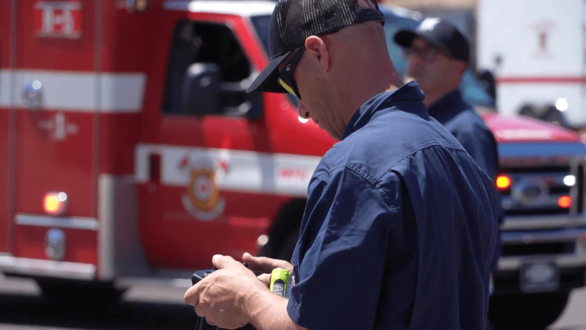
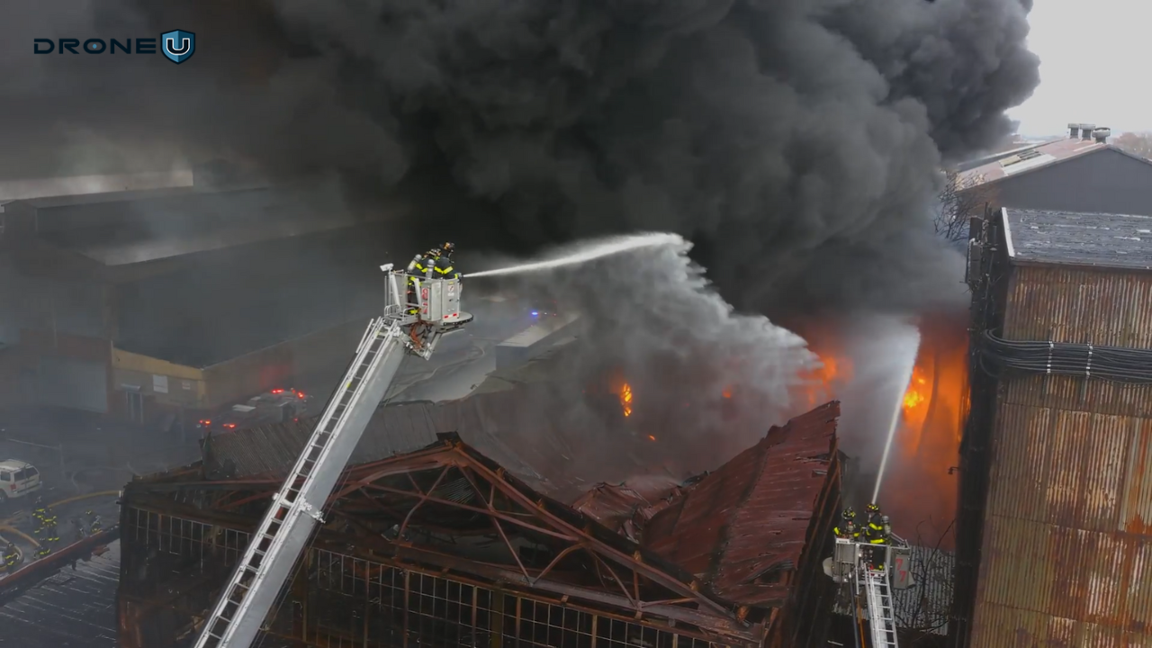
5. Drone Jobs in Public Safety
Public safety teams use drones for many purposes, including search and rescue, firefighting, disaster response, and wildlife protection. These roles can be part-time or full-time and offer both financial rewards and meaningful work.
Here’s how drones are making a difference:
A. On The Frontline:
1. Search and rescue: Drones scan large areas and help locate lost hikers, flood victims, or anyone needing urgent help.
2. Disaster response: After hurricanes, floods, or earthquakes, drones assess damage, deliver supplies, and help first responders make informed decisions.
3. Wildlife conservation: Agencies use drones to track endangered species, monitor animal movements, and identify poaching activity.
B. Supporting Local Heroes:
1. Law enforcement: Drones create 3D maps that help teams plan evacuations, track suspects, and understand complex environments during emergencies.
2. Fire departments: Drones provide real-time aerial views that help firefighters locate victims and assess hazards. They also create orthomosaic maps of schools and public buildings, giving responders a clear view of exits and safety routes before an incident occurs.
However, the ability to use drones in public safety may vary considerably based on the purpose.
Firefighters use drones to enhance their situational awareness during fires. They also use drones to create orthomosaic maps of local schools and other buildings/facilities. This helps firefighters identify all the exit points, ensuring they have a clear view of the safest escape routes in case of a fire.
Skills Needed to Work in Public Safety
To work in public safety as a drone pilot, you may need specialized training or certification. A background in emergency services, law enforcement, or related industries can be helpful.
You also need:
strong communication skills
knowledge of drone regulations
familiarity with public safety tools and software
the ability to follow procedures in high-risk environments
These skills help you stay safe and operate effectively in fast-moving, high-pressure situations.
Merits and Demerits of Choosing the Public Safety Industry
1. Dependence on weather conditions, especially in challenging situations such as storms or low visibility.
2. Enhanced situational awareness during law enforcement operations, improving public safety.
2. Initial training and certification may be time-consuming, impacting immediate deployment.
3. Quick deployment for monitoring large crowds, traffic management, and event security.
3. Privacy concerns and public perception issues regarding the use of drones in surveillance.
Types of Drone Work in Public Safety
There are a variety of different types of missions that UAV operators in public safety
These often include:
Crime scene mapping
Search and rescue operations
Accident investigation and traffic control
Disaster response and damage assessment
Emergency support missions
Here are some of the most common roles in more detail:
1. Search and Rescue Operations:
Search and rescue is one of the most frequent missions for public safety pilots. Drones can scan large areas and reach places that rescuers on foot cannot.
When equipped with thermal cameras, drones can locate missing people in dark, foggy, or low-visibility conditions.
2. Disaster Relief and Emergency Logistics:
Another common mission type for public safety UAS operators is disaster relief logistics. In these situations, drones can be an asset in transporting supplies and equipment to areas affected by a natural disaster.
This can be particularly valuable in situations where roads and other infrastructure have been damaged or destroyed, making traditional methods of transportation inaccessible.
3. Wildlife Conservation and Environmental Monitoring:
Public safety teams also use drones to support conservation efforts. Pilots can map natural habitats, track animal populations, and monitor protected areas.
Drones also help identify illegal hunting or poaching activity without putting personnel at risk.
Understand Why Most Pilots Stay Stuck
Learn the mistakes that keep pilots chasing $200 jobs and what successful operators do differently to build consistent income.
Key Points
The 3 mistakes that prevent real income growth
Why specialization matters more than equipment
How professionals create repeatable workflows
What clients actually pay for (and how to communicate value)
Thank you!
Thank you. You will now be redirected to your requested resource.
6. Drone Pilot Jobs in Insurance
Insurance companies often use drones to create 3D maps of properties. This helps them assess risk and calculate premiums more accurately.
After severe weather events, insurers may receive hundreds of roof damage claims in a single area. Traditionally, adjusters had to visit each home in person, climb ladders, and take photos of the damage.
With drones, a pilot can capture roof imagery in 20–30 minutes by flying a pre-planned route. The footage provides all the details needed to evaluate a claim without a manual inspection.
This type of work is simple to perform, in high demand, and far more cost-effective than traditional methods.
Merits and Demerits of Choosing the Insurance Industry
Here are the key advantages and disadvantages:
Merits
Demerits
1. Ability to capture hard-to-reach areas such as rooftops or remote locations, improving accuracy in assessing damages.
1. Challenges in integrating drone data with existing insurance systems and processes, leading to potential workflow disruptions.
2. Facilitates the documentation of pre-existing conditions and property features for comprehensive insurance records.
2. Concerns over data security and privacy breaches related to the storage and transmission of aerial imagery.
3. Enhances customer satisfaction through faster claim processing and transparent damage assessments.
3. Liability risks associated with drone accidents or errors in data interpretation, leading to potential legal disputes.
4. Provides actionable insights for risk mitigation and policy adjustments based on detailed aerial observations.
4. Limited availability of skilled drone pilots with specialized knowledge of insurance industry requirements, leading to resource constraints.
Applications of Drones in Insurance Work
Some of the most common types of missions include damage assessment, property inspection to document risk and/or an asset, mapping, and even surveying.
Damage assessment missions involve capturing aerial images after natural disasters such as hurricanes, fires, or severe storms. These images help insurers understand the scale of damage and prioritize claims.
Property inspection missions focus on individual homes or commercial buildings. Pilots gather detailed visuals of roofs and structures to support claims reporting and policy evaluations.
Mapping missions use specialized software to create high-resolution maps and 3D models. These maps help insurers assess risk, verify property conditions, and calculate accurate valuations.
Surveying missions cover larger areas and help with land assessments, boundary evaluations, and planning decisions.
Overall, UAV pilots play an important role in the insurance industry by helping companies assess damages, inspect properties, and gather valuable data on a range of different areas.
Many insurance companies now offer internships or apprenticeship programs to help new drone pilots gain hands-on experience in the field.
Interested in augmenting drones in the insurance industry?
Drones are reshaping how news is captured and consumed. The war in Ukraine is a clear example of how often drones are now used to document events in the field. Aerial footage adds detail, scale, and context that traditional ground cameras can’t provide.
Drones capture scenes that were once out of reach. They offer vantage points that help viewers understand the full impact of floods, wildfires, protests, or large crowds. This gives audiences a more complete picture of what’s happening on the ground.
Not every journalism mission requires high-end equipment. For breaking news, simply capturing usable footage may matter more than cinematic quality. But for longer documentary-style projects, a higher-end drone with a customizable payload is useful. It allows you to attach a dedicated camera and capture true cinematic images.
Merits and Demerits of Choosing the Journalism Industry
Drones give journalists new ways to tell stories with compelling aerial visuals. However, they also come with unique challenges, including safety, regulations, and ethical concerns. Here’s how both sides compare:
Merits
Demerits
1. Provides access to otherwise inaccessible or hazardous areas for investigative reporting.
1. Potential for interference or obstruction of emergency response efforts when drones are used in news coverage of accidents or disasters.
2. Enables coverage of environmental issues and conservation efforts from aerial perspectives, fostering awareness.
2. Challenges in maintaining objectivity and credibility in journalistic storytelling when relying heavily on aerial footage.
3. Facilitates real-time reporting and live streaming of events, enhancing audience engagement and immediacy.
3. Limited battery life and flight range of drones may restrict coverage duration and scope, particularly for extended events or remote locations.
4. Concerns over airspace congestion and potential conflicts with other drone operators or manned aircraft during news coverage assignments.
Applications of Drones in Journalism Work
Drone pilots working in journalism can take on many types of missions, including:
Surveillance and monitoring during active events or developing situations
Traffic reporting to track congestion, accidents, and road conditions
Mapping support to provide visual context for large areas or ongoing stories
Disaster coverage during fires, floods, storms, hurricanes, and other natural events
Live incident reporting for shooting scenes, hostage situations, or collapsed structures, where caution and discretion are essential
Photojournalism that uses high-quality aerial imagery to tell visual stories
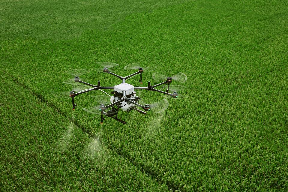
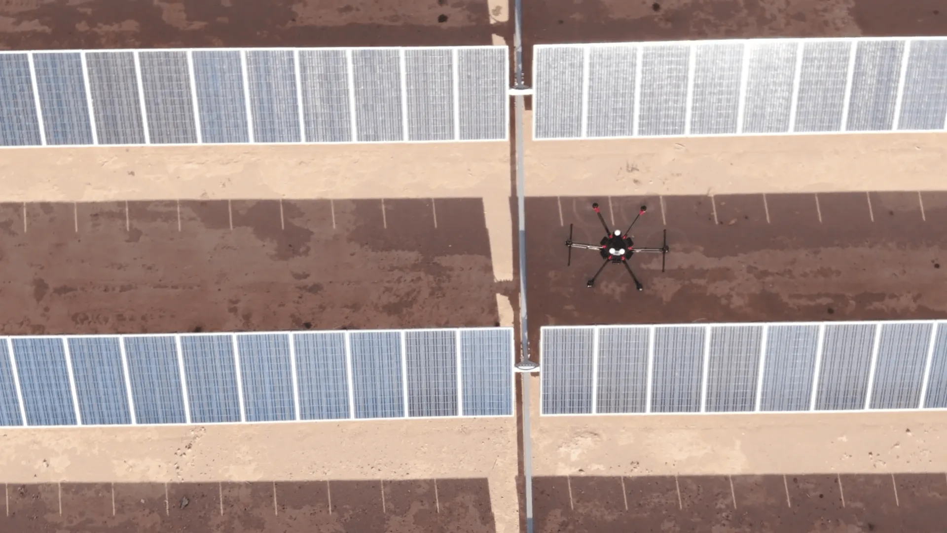
8. Drone Jobs in Agriculture
According to MarketsandMarkets, the global agriculture drones market is expected to grow from USD 2.63 billion in 2025 to USD 10.76 billion by 2030, at a CAGR of 32.6%.
The agriculture sector continues to be one of the strongest markets for UAS operators, offering growing opportunities for pilots with the right skills and training.
Agriculture pilots work with more than just flight operations. They also use specialized software to collect, analyze, and interpret aerial data. This includes tools for crop health monitoring, plant counting, field mapping, and yield prediction.
Agriculture pilots work with more than just flight operations—they also use specialized software to collect, analyze, and interpret aerial data. This includes tools for crop health monitoring, plant counting, field mapping, and yield prediction.
As a drone pilot in agriculture, you could work directly for a farm or ranch, support agricultural service providers, or operate independently as a consultant. Many pilots also start their own drone service businesses, offering crop scouting, mapping, spraying support, and field-monitoring services.
Beyond flying skills, agricultural missions require strong decision-making abilities. Pilots must interpret aerial data accurately, recognize early signs of crop stress or disease, and understand potential hazards affecting field performance.
Merits and Demerits of Choosing the Agriculture Industry
Let’s break down the advantages and disadvantages of being a drone operator in the agriculture industry.
Merits
Demerits
1. Precision agriculture through aerial imagery enables efficient crop monitoring and management.
1. Initial investment in drone technology and training may be costly for small-scale farmers.
2. Early detection of crop diseases, pest infestations, and nutrient deficiencies, allowing timely interventions.
2. Limited flight time and battery capacity may require multiple flights for large farm operations.
3. Optimized resource utilization through data-driven decision-making, leading to increased yield and cost savings.
3. Complex data analysis and interpretation may require specialized knowledge and technical expertise.
4. Improved mapping and analysis of field variability, facilitating targeted treatment and precision spraying.
4. Integration challenges with existing farm management systems and workflows may disrupt adoption.
Types of Work in Agriculture That Involves Drone Technology
UAV operators typically fly a number of different missions in the agriculture industry, including crop scouting, crop mapping, and livestock monitoring.
Crop scouting involves flying over fields to spot issues like pests, disease, plant stress, or nutrient deficiencies. By identifying problems early, farmers can make timely decisions and reduce crop loss.
Crop mapping uses aerial imagery to create detailed maps showing crop performance across large fields. These maps help farmers plan treatment zones, optimize planting patterns, and improve overall yield.
Livestock monitoring uses drones to track herd movement, grazing behavior, and signs of heat stress or injury. This is especially valuable on large ranches where manual tracking can be time-consuming.
Irrigation Monitoring uses drones equipped with thermal sensors to detect over- or under-watered sections of farmland. This helps farmers improve water distribution and spot clogged or damaged irrigation lines.
Soil and Field Analysis relies on aerial data and 3D mapping to evaluate soil quality, nutrient levels, and problem zones. These insights guide decisions on planting density, fertilizer application, and resource allocation.
Together, these missions help farmers operate more efficiently while reducing manual labor, travel time, and crop waste.
A more recent example comes from the Georgia Department of Transportation. Its FY 2024 UAS report shows that drones are now used for routine work like surveying, inspections, and data collection. This means drone programs are no longer experimental. They are part of the day-to-day operations in many states.
As this adoption grows, the demand for trained drone pilots will remain strong in 2026.
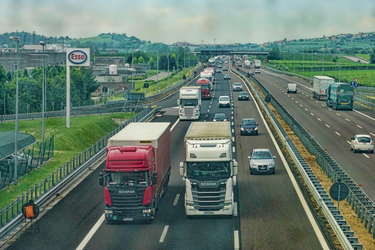
Drones are also transforming the transportation sector. They can make travel and logistics faster and more efficient. Instead of walking rail lines or roadways to spot issues, inspectors can now use drones to collect accurate data in minutes.
BNSF Railway was one of the first private partners of the FAA’s Pathfinder Program. Their research focused on Beyond Visual Line of Sight (BVLOS) flights to support railway inspections. This work helped shape how drones can be used safely at scale.
You can use drones in transportation to revolutionize package delivery, provide seamless taxi services, and even introduce cutting-edge solutions for public transport.
To be successful as a drone pilot in the transportation sector, you need strong technical skills and a solid understanding of aviation regulations.
Merits and Demerits of Choosing the Transportation Industry
Here are the key advantages and disadvantages:
Merits
Demerits
1. Rapid assessment of hard-to-reach or dangerous areas during transportation infrastructure emergencies.
1. Challenges in integrating drone data with existing transportation management systems, leading to potential coordination issues.
2. Aerial monitoring of wildlife crossings and potential hazards on roadways, enhancing safety measures.
2. Concerns over public perception and potential backlash related to privacy issues during aerial monitoring in urban areas.
3. Facilitates efficient inspection of tunnels, bridges, and remote transportation infrastructure, improving maintenance.
3. Limited acceptance and understanding of drone technology within traditional transportation management practices.
4. Quick deployment for traffic flow analysis during major events or construction, optimizing transportation routes.
4. Liability concerns and insurance complexities related to accidents or damages involving drones in transportation operations.
Types of UAS Work in the Transportation Industry
There are many types of work that UAV operators can perform within the transportation industry, including:
Inspecting railway ties and tracks to detect difficulties before they become worse is an important task.
Assessing monorail structures, including concrete supports and rails
Monitoring areas at risk of landslides, flooding, or rock falls using aerial data
Drones are increasingly being used for package delivery, cargo movement, and even emerging forms of passenger transport. Whether you’re working with logistics companies or public transit systems, drone-powered mobility offers a growing range of opportunities.
Companies use them to collect data faster, reduce field risks, and monitor assets more accurately. Energy firms hire UAS operators for a range of tasks, including:
aerial photography and videography
surveying and mapping
pipeline and transmission line monitoring
thermal inspections
logistics support during environmental cleanup
BVLOS Approvals in the Energy Sector
One major development is the FAA granting Beyond Visual Line of Sight (BVLOS) waivers to approved energy companies. BVLOS allows drones to fly beyond the pilot’s field of view, making it possible to inspect long transmission lines and large sites more efficiently.
The FAA issued its first BVLOS waiver to an energy company, Xcel Energy 2018 for power line inspections near Denver, Colorado. After the initial project, Xcel expanded BVLOS operations to other states. As more waivers are approved, energy companies can run larger inspections with fewer on-site personnel, increasing demand for trained UAV operators.
Skills Needed for Drone Jobs in the Energy Sector
To work in this field, pilots need technical knowledge of power lines and solar infrastructure, along with strong navigation and safety skills. Thermography is especially important for detecting electrical faults, overheating panels, or failing components.
Power lines can cause magnetic interference that affects flight controllers, so maintaining safe distances and avoiding flying between lines is essential. Most operators keep at least 100 feet of clearance during inspections.
By combining flight skills with inspection knowledge and thermal imaging expertise, pilots can become highly valuable assets to utility companies.
Merits and Demerits of Choosing the Energy Industry
Here are the key advantages and disadvantages:
Merits
Demerits
1. Using drones to look for any troubles early on means energy places can fix things before they get worse, which costs less money in the long run.
1. Some energy places are out in the middle of nowhere or tricky spots, so flying a drone there can be hard and needs special skills.
2. Drones monitor the environment around energy plants and ensure that nothing harms the environment.
2. Drones monitor the environment around energy plants and ensure that nothing harms the environment.
3. Drones can fly around and check on important energy sites. These are Oil pipelines, windmills, or solar panels without anyone having to climb up or get into risky spots.
3. Flying drones, especially near important energy sites, means dealing with a lot of rules that can change depending on where you are.
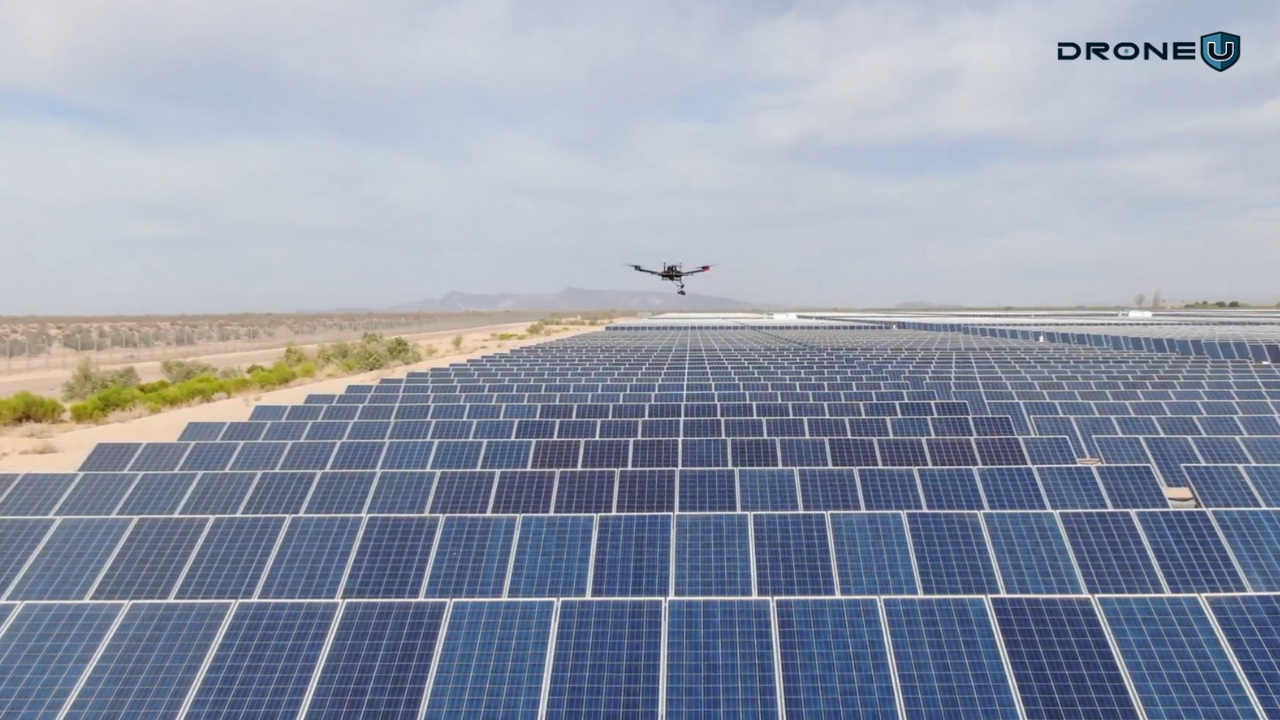
Types of Drones Work in Energy
Energy companies use drones to inspect power lines, solar farms, wind turbines, and pipelines. These assets span large areas, so drones help teams collect data faster, reduce field risk, and identify issues before failures occur.
Traditionally, inspection teams relied on helicopters or manual ground inspections. These methods were slow, expensive, and unsafe in locations with steep terrain, live electrical systems, or remote access points. With drones, a trained pilot can survey miles of infrastructure in a single flight and deliver high-resolution visual or thermal data to maintenance teams.
Here are some common tasks in energy-related drone work:
Power line inspections: Detecting damaged insulators, corrosion, vegetation encroachment, and overheating lines using visual and thermal cameras.
Solar farm inspections: Using thermal imaging to find hotspots, broken panels, or connection failures across large solar fields.
Wind turbine inspections: Capturing close-range imagery of blades, nacelles, and turbine infrastructure to detect wear or surface damage.
Pipeline monitoring: Detecting leaks or corrosion over long distances and spotting environmental risks such as erosion or ground movement.
Infrastructure assessments: Inspect stations, support beams, substations, and other assets using drone data.
These missions help energy companies maintain assets, reduce field risk, and spot issues before they become serious failures. Pilots must also follow Part 107 rules, utility safety protocols, and often coordinate with field crews and airspace authorities.
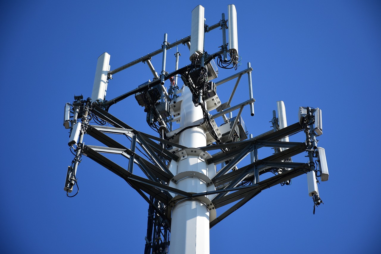
11. Drone Operator Jobs in Telecommunications
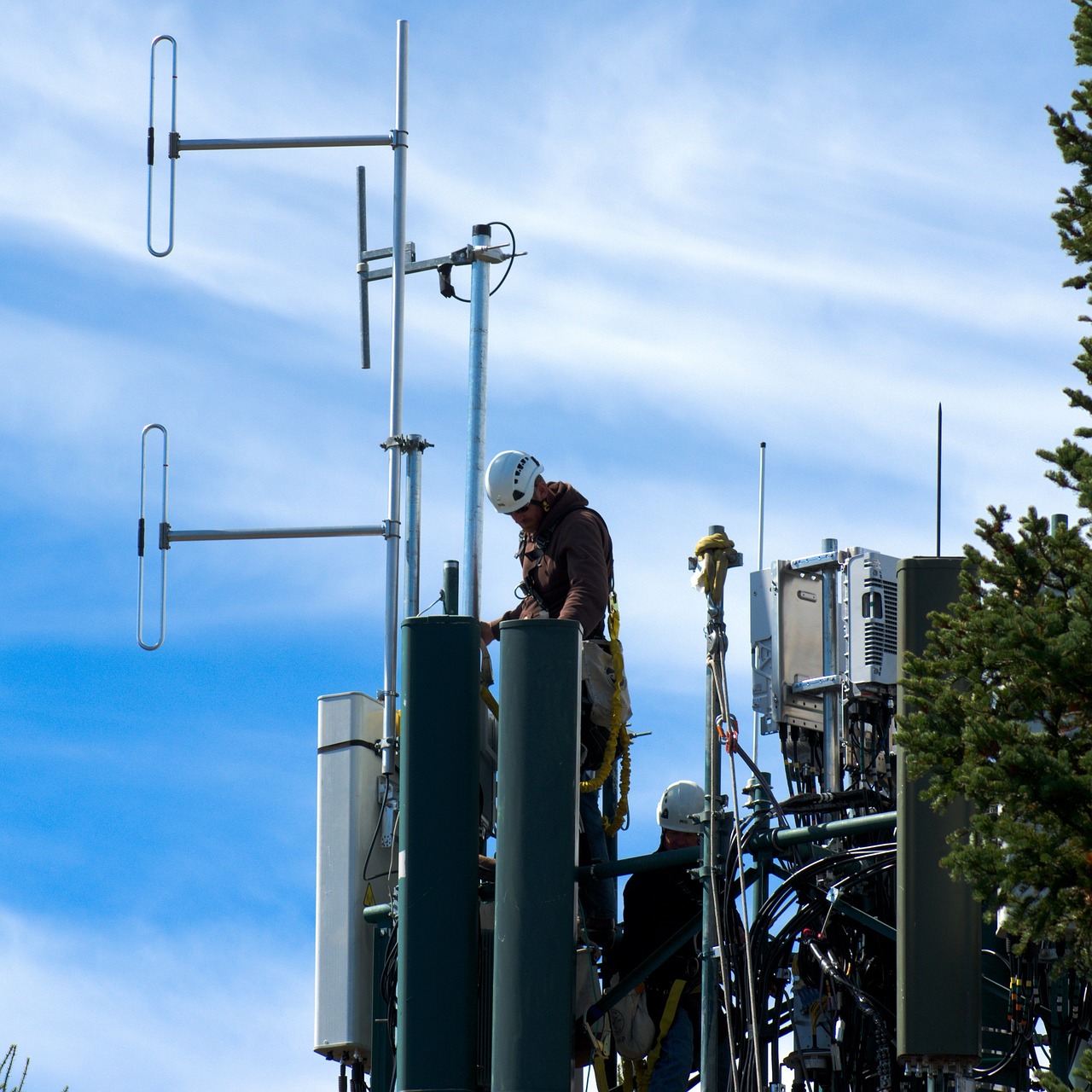
The telecommunications industry uses drones to inspect cell towers, radio masts, and network infrastructure without sending workers into hazardous areas. This speeds up inspections, reduces climbing risks, and provides detailed visual and thermal data for maintenance teams.
In the past, tower inspections required lift trucks or manual climbs. These methods were slow, costly, and dangerous. With drones, a trained pilot can collect high-resolution imagery in minutes while staying safely on the ground.
Common missions in telecommunications include:
Cell tower inspections: Capturing visual and thermal data to detect loose mounts, damage, rust, or alignment issues.
Radio tower inspections: Checking antenna positioning, cables, grounding systems, and equipment wear.
Network maintenance and upgrades: Verifying installation work, checking alignment after weather events, and documenting repairs.
Equipment verification & deployment support: Providing visuals before and after upgrades or new installations.
AT&T has used drones for tower inspections for several years. Verizon has also invested in the drone space and even acquired the drone company Skyward in 2017 to support aviation software and airspace management.
One unique challenge in this sector is electromagnetic interference (EMI). Cell towers emit strong signals that can interfere with a drone’s compass, GPS lock, or flight controller. Pilots must maintain a safe distance of about 100 feet and use optical zoom payloads instead of flying close to antennas.
To work in telecom inspections, pilots must:
understand how towers are structured
plan safe flight paths with minimal interference
gather high-resolution data without risking equipment or personnel
Drones make it easier to inspect areas that are hard to reach and dangerous to climb. A drone can inspect a full tower in minutes, while a crewed climb may take hours and require extensive safety protocols.
Drones can also transport small parts or tools to remote sites when crews are already deployed in the field, saving time and improving workflow.
As telecom companies continue integrating drones into their operations, demand for skilled UAV pilots is set to grow through 2026 and beyond.
Merits and Demerits of Choosing the Telecommunication Industry
Here are the key advantages and disadvantages:
Merits
Demerits
1. Using drones keeps workers safe on the ground, away from dangerous heights or tough spots.
1. Drone pilots need to be careful that their drones don’t accidentally disrupt the telecom signals.
2. Drones can take detailed pictures and videos, helping figure out what parts of the network might need a boost or fix.
2. Telecom tech changes fast, so drone pilots need to keep learning new stuff to stay up to date.
3. Spotting problems with drones means fixing things faster and cheaper, without having to send out lots of people to check.
3. Some telecom sites are way out there or hard to get to, needing really good flying skills and drones that can handle the trip.
Types of Drone Operator Jobs in the Telecommunication Industry
Telecommunications work offers a variety of opportunities for UAS pilots. Some of the most common types of missions that drone operators fly in this field include:
Cell tower inspections
Network maintenance and field verification
Telecom infrastructure data capture specialist
Equipment installation and upgrade support
Emergency response support during outages and storms
These roles typically involve high-zoom imaging, thermal inspections, RF interference management, and post-processing data delivery for telecom engineering teams.
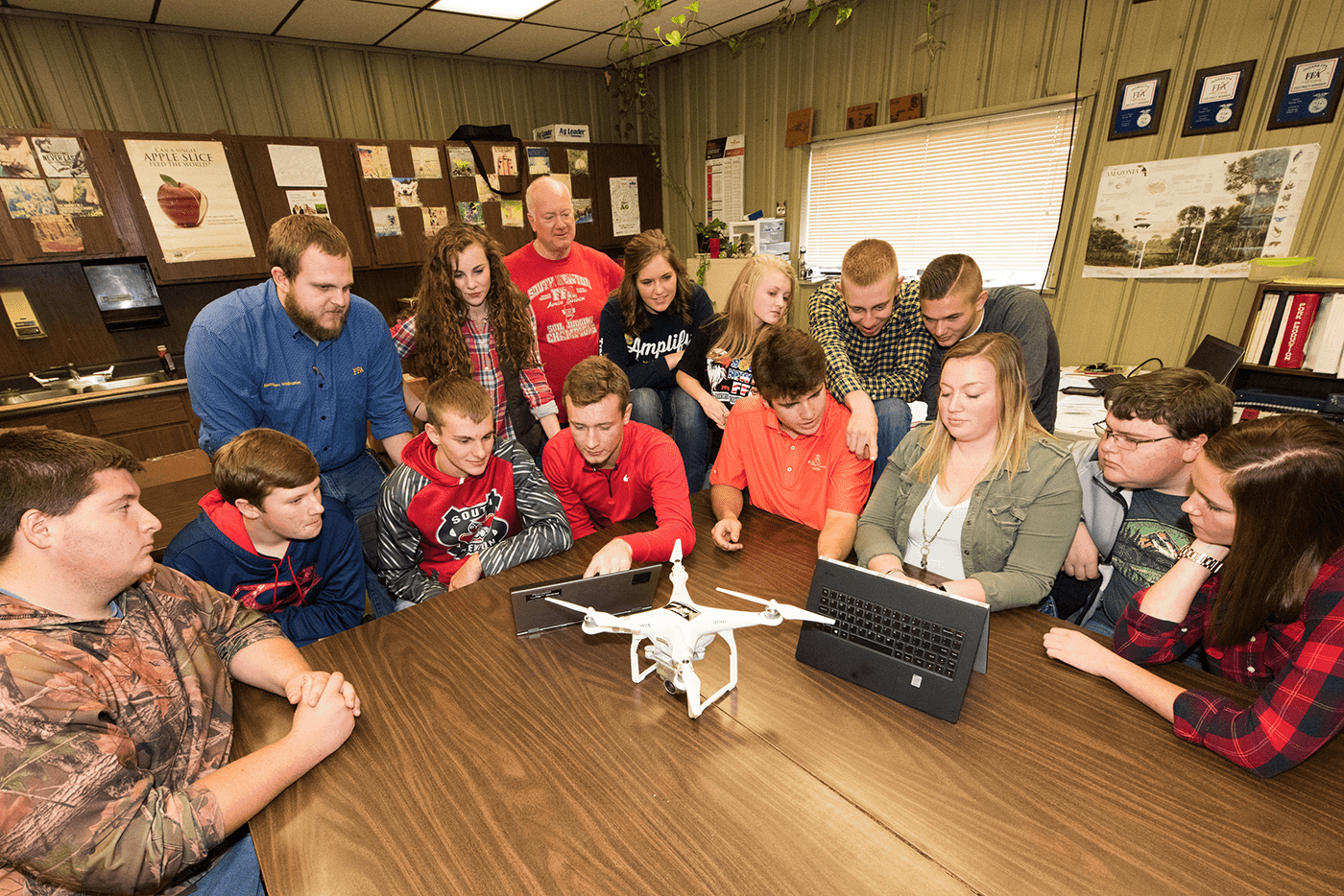
12. Drone Jobs in Education & Training
Credit: FFA
Drones can enhance classroom learning, help with research, and introduce students to new technology. They are increasingly used in science, technology, engineering, and mathematics (STEM), which means more schools and colleges are integrating UAV training into their curriculum.
Common roles for drone pilots in education include:
assisting instructors with flight demonstrations
supporting research projects with aerial data
helping develop new training programs and UAV applications
offering hands-on instruction for new pilots
A 2019 Michigan study reported that only 37% of 131 surveyed agriculture and natural resources teachers used drones in their curriculum. Many cited limited subject knowledge and a lack of access to equipment due to funding constraints. That number reflected low familiarity with drone technology and limited funding.
Since then, drone adoption in education has grown.
ASSURE’s 2023–2024 UAS programs reached thousands of students through school camps and roadshows. These programs helped students learn flight skills, safety rules, and basic drone operations.
A 2024 STEM and CTE study found that drones can be integrated into classroom activities across multiple subjects. Teachers reported that drones help students build problem-solving, programming, and mapping skills.
Schools are still working to make drone programs sustainable. Many districts need industry partnerships, equipment funding, and trained instructors to keep drone courses running year after year.
Regulations to Keep in Mind
U.S. regulations limit who can fly drones and where they can operate. The FAA requires registration for drones over 0.55 pounds and restricts flights to 400 feet or below within visual line of sight.
Under CFR Part 107, educational drone flights have fewer restrictions, but students must complete aeronautical safety training and pass the Recreational UAS Safety Test (TRUST), which is available online at no cost.
Several colleges now offer structured drone programs, including:
Merits and Demerits of Choosing the Education Industry
Bringing drones to schools and colleges can make learning fun and prepare students for the future. Here are the pros and cons of bringing drones into the education industry.
1. Budget constraints may limit access to drone technology and training resources in educational institutions.
2. Facilitates field research and environmental studies through aerial observation and data collection.
2. Safety concerns and regulatory compliance issues in integrating drones into educational curricula.
3. Enhances creativity and problem-solving skills through drone programming and mission planning activities.
3. Limited opportunities for hands-on flight experience due to airspace restrictions and liability concerns.
4. Provides practical applications for geography, mapping, and surveying concepts through drone technology.
4. Technical challenges in drone maintenance, repair, and troubleshooting may disrupt educational activities.
Apps & Curriculum Resources for Drone Education
Several apps and curriculum tools help instructors teach drone skills.
For example, the Drone U Flight School app prepares students for the FAA Part 107 exam. The Aerial Robotics Curriculum provides lesson plans and hands-on activities for teaching drone technology in classrooms.
Other useful resources include DroneBlocks, which offers STEM-focused drone lessons, coding tools, simulators, and professional development.
The DroneDeploy app lets users create and share 3D maps and models. The Flight Projector app allows users to display a live drone camera feed on a classroom screen.
Schools, universities, and training centers are building structured drone programs to support STEM learning and technical career pathways. This creates ongoing opportunities for certified pilots who can assist with instruction, curriculum development, and lab training.
13. Emergency Response Drone Operations
Emergency response agencies use drones for search and rescue missions, disaster assessment, and real-time situational awareness. This helps teams respond faster and more effectively while keeping responders out of dangerous areas.
During natural disasters, accidents, or search operations, teams often receive multiple calls in the same region. In the past, they relied on helicopters or ground crews, which could take hours to mobilize and were limited by terrain and weather.
Drones change this process. A trained pilot can launch within minutes and deliver immediate aerial intelligence. With thermal sensors and high-resolution cameras, drones can scan large areas in one to two hours and feed live data to responders on the ground.
This type of work is increasingly in demand because it improves response time, enhances visibility in complex environments, and reduces risk to emergency personnel.
Merits and Demerits of Choosing Emergency Response
Here are the key advantages and disadvantages:
Merits
Demerits
1. Direct involvement in life-saving operations and the ability to make an immediate impact in critical situations
1. High-stress working conditions with the pressure of time-critical missions affecting decision-making
2. Access to advanced technology including thermal imaging and specialized rescue equipment
2. Irregular working hours with on-call requirements impacting work-life balance
3. Rapid career advancement opportunities due to the growing adoption of emergency services
3. Weather dependencies limiting operation capabilities during adverse conditions
4. Development of diverse skill sets across multiple types of emergency scenarios
4. Complex regulatory compliance requirements for emergency operations in restricted airspace
Applications of Drones in Emergency Response
Some of the most common missions in emergency response include search and rescue, disaster assessment, fire monitoring, and emergency supply delivery.
Search and rescue: Pilots use drones with thermal cameras to locate missing people across different terrains and weather conditions. This helps responders narrow search zones quickly.
Disaster assessment: Drones map affected areas to identify damage, plan access routes, and guide response teams. The data helps agencies send resources where they’re needed most.
Fire monitoring: Specialized thermal sensors help track wildfire spread and detect hotspots. This gives firefighters real-time visibility without sending crews into unsafe areas.
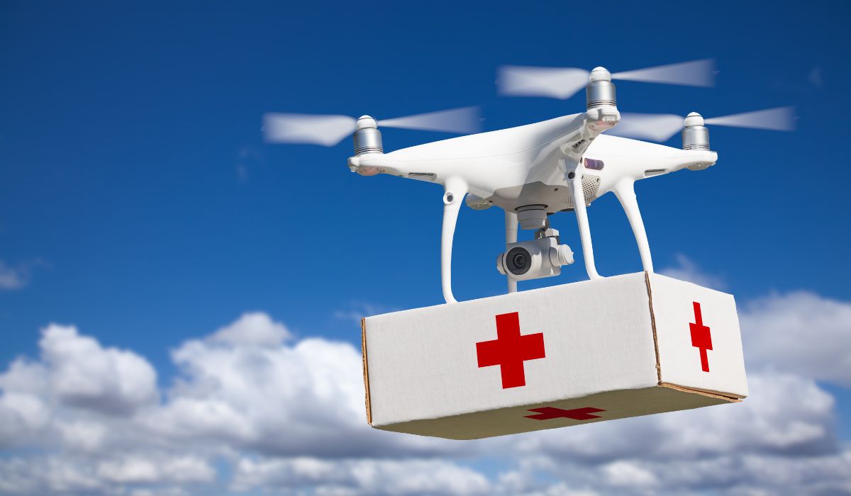
Emergency supply delivery: Drones can transport medical kits, communication devices, and other essential supplies to unreachable locations when ground routes are blocked.
UAV pilots play a key role by providing fast aerial coverage, improving situational awareness, and giving ground teams real-time intelligence.
Many emergency response agencies also offer training programs or partner with certified drone operators, making it easier to gain hands-on experience in this field.
The healthcare industry uses drones to transport time-sensitive medical supplies, blood samples, vaccines, and diagnostic materials between facilities. This helps hospitals deliver critical items faster, especially in rural or hard-to-reach areas.
Before drones, urgent medical deliveries depended on ground transport or helicopters. These methods were often delayed by traffic, cost, and limited access. With drones, a trained pilot can complete the same delivery in minutes by flying predetermined routes while maintaining required temperature and handling conditions.
This work is becoming more common as hospitals and logistics companies build routine drone delivery programs rather than using drones only during emergencies.
Merits and Demerits of Choosing Healthcare Logistics
Here are the key advantages and disadvantages:
Merits
Demerits
1. Direct contribution to saving lives through rapid medical deliveries and improved healthcare access
1. Strict regulations and protocols for handling medical supplies requiring specialized certifications
2. Regular working hours with predictable flight schedules and routes
2. High responsibility for maintaining temperature-controlled conditions during transport
3. Growing demand in both urban and rural healthcare settings
3. Limited payload capacity affecting the types of medical supplies that can be transported
4. Opportunity to work with advanced delivery systems and tracking technology.
4. Need for backup plans and redundancy systems in case of technical issues
Applications of Drones in Healthcare Logistics
Some of the most common missions in healthcare logistics include medical supply delivery, lab sample transport, vaccine distribution, and emergency equipment delivery.
Medical supply delivery: Transport urgent medications, small devices, or essential supplies between healthcare facilities.
Laboratory sample transport: Move biological samples while maintaining the required temperature and handling conditions.
Vaccine distribution: Deliver temperature-sensitive vaccines to remote or hard-to-reach locations where ground transport is slow or unavailable.
Emergency equipment delivery: Provide critical devices or supplies during time-sensitive situations, such as disaster response or hospital shortages.
Hospitals, public health agencies, and logistics companies are building long-term drone delivery networks to reduce transport time, cut costs, and improve access to care. This creates steady job roles for UAV operators, route managers, and compliance specialists.
Many healthcare organizations also offer training in medical handling and transport protocols to help pilots gain experience in this growing field.
15. Urban Planning Drone Operations
Urban planning teams use drones to map neighborhoods, inspect public infrastructure, and monitor development projects. This gives planners accurate, up-to-date data for zoning, construction approvals, and long-term city design.
Previously, most planning work relied on satellite imagery or slow ground surveys. These methods often lacked detail and couldn’t capture real-time changes.
With drones, a trained pilot can map entire districts in a single day and create detailed 2D and 3D models for planning and compliance reviews.
Merits and Demerits of Choosing Urban Planning
Here are the key advantages and disadvantages:
Merits
Demerits
1. Stable work environment with regular hours and planned project schedules
1. Complex data processing requirements needing specialized software knowledge
2. Opportunity to contribute to long-term city development and improvement
2. Restricted flight zones in urban areas requiring additional permits
3. Integration with emerging smart city technologies and planning tools
3. Project delays due to weather conditions or air traffic restrictions
4. Diverse project portfolio across different urban environments
4. High accuracy requirements for mapping and modeling data
Applications of Drones in Urban Planning
Cities need frequent data updates for infrastructure projects, zoning approvals, transportation planning, and environmental monitoring. As smart city programs expand, more planning departments are partnering with drone operators or hiring in-house pilots to support ongoing mapping and analysis.
Some of the most common missions in urban planning include:
Urban mapping: Create detailed 3D models of city blocks, neighborhoods, or districts to support planning and development.
Infrastructure inspection: Collect visual data on buildings, roads, utilities, and public structures to support maintenance and compliance.
Development monitoring: Track construction progress, verify site conditions, and ensure projects follow approved plans and zoning rules.
Environmental assessment: Capture data on green spaces, water bodies, and environmental impact to support sustainability projects.
These missions support smart city initiatives by providing accurate data for planning decisions, budgeting, and resource allocation.
Many planning departments also offer internships or project collaborations that can help you gain experience in this field.
In the following sections, you will find some valuable information on drone pilot earnings and recommendations on drones & software based on the industry.
Earning Potential in Drone Pilot Jobs as Per Industry
Choosing the right drone pilot jobs early in your journey directly impacts how your drone pilot career grows in 2026. Each type of job helps you build different skills.
Real estate work strengthens your camera and media skills.
Construction and mining projects help you learn mapping and surveying.
Insurance and energy jobs teach you structured inspection workflows.
Public safety builds rapid-response, situational awareness, and mission planning abilities.
And with these skills in mind, let’s look at how much drone pilots can earn in 2026.
1. Is becoming a drone pilot a good career choice?
Yes. Drone piloting offers career opportunities across industries like energy, construction, agriculture, public safety, and media. The field continues to expand as more organizations integrate UAVs into day-to-day operations.
2. Is there demand for drone pilots in 2026?
Yes. Demand for drone pilots is increasing as companies adopt drones for mapping, inspections, thermal imaging, logistics, and emergency response. Sectors like infrastructure, utilities, and agriculture are seeing the highest growth.
3. How do I become a certified drone pilot?
To become a commercial drone pilot in the U.S., you must pass the FAA Part 107 exam. Most pilots prepare through online training and hands-on practice.
4. How much do drone pilots make?
Entry-level drone pilots typically earn $25–$45 per hour. Experienced pilots in mapping, inspections, and BVLOS operations can earn $70,000–$130,000+ annually.
5. Which industries offer the most stable drone pilot careers in 2026?
The most reliable drone pilot jobs in 2026 are found in energy, construction, agriculture, insurance, and utilities. These industries use drones as part of daily operations, creating steady roles instead of temporary or project-based work.
Paul Aitken is a Certified Part 107 drone pilot and a Certified Pix4D Trainer. He is a pioneer in drone training and co-founder of Drone U. He created the industry’s first Part 107 Study Guide and co-authored Livin’ the Drone Life.
Paul is passionate about helping students fly drones safely and effectively. With over a decade of experience, he has led complex UAS projects for federal agencies and Fortune 500 clients such as Netflix, NBC, the NTSB, and the New York Power Authority.
Related Articles
The Top 36 Drone Companies in 2025
How to Choose the Best Drone for Cinematic Filmmaking


 Source:
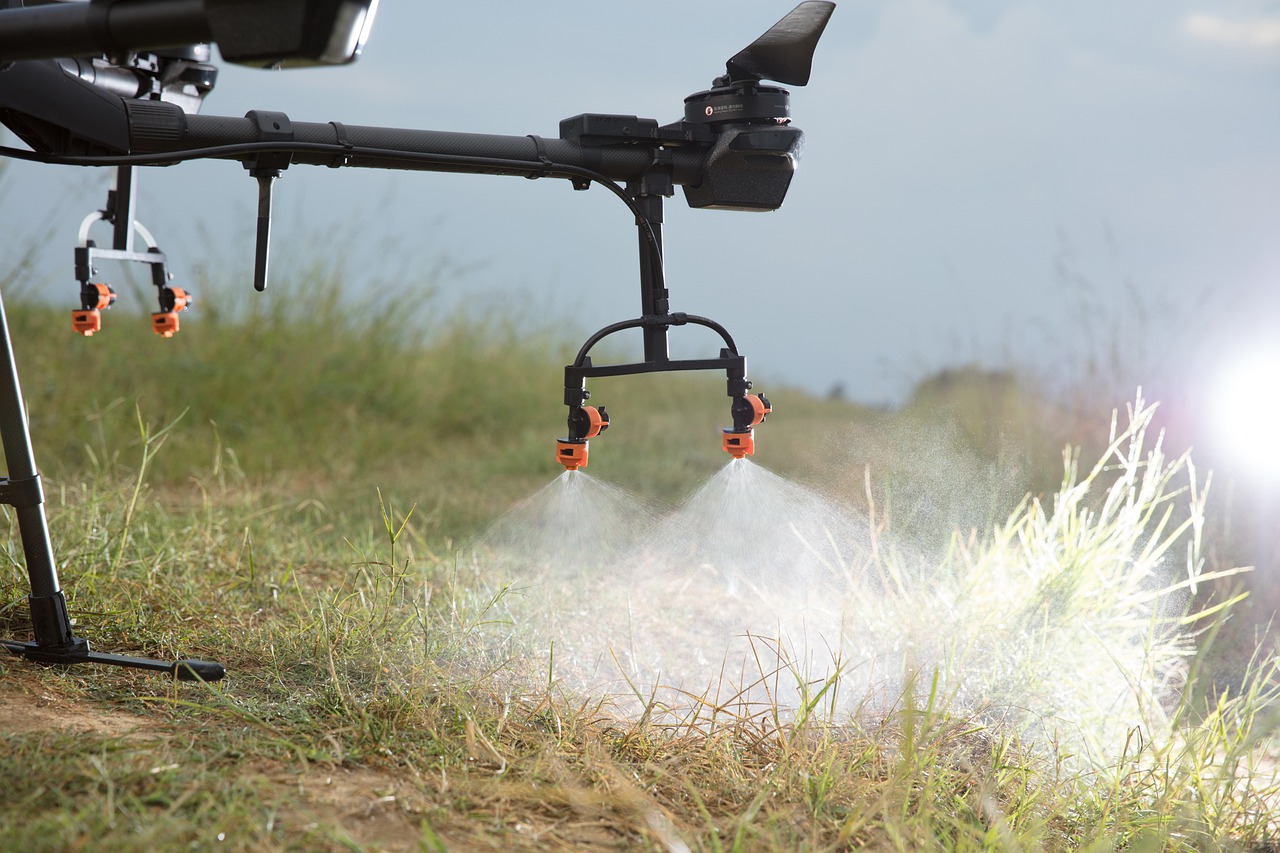

 Credit: FFA