In this blog post, we share 4 steps for completing your first drone mapping project. We discuss 1) Drone Education 2) Mapping Drones 3) Applications & 4) Accessories
Steps for Executing your First Drone Mapping Project (Click to Jump)
Step 1. Learn How to Map with a Drone
Drone mapping is a lucrative but complicated field that requires you to master data acquisition, processing, and delivery. To gain expertise and truly evolve into a professional mapper, learning from expert pilots with real-world experience is the most effective approach.
At Drone U, we offer two ways of learning drone mapping:
- Online Courses
- In-person mapping classes
Comprehensive Mapping Course
Let’s talk about our online courses first. We just pushed out our “Comprehensive Mapping” course. Aptly titled, this course consists of 14 lessons that cover all possible aspects of drone mapping.
You will learn about –
- Hardware and software selection
- Data Acquisition Techniques
- Tips & Tricks for using Pix4D
- How to set GCP’s
- Point Cloud Editing and Clean-up
- Merging Projects and much, much more…
In this mapping course, you will also gain access to 3 exercises that will give you a chance to practice your mapping skills. Apart from this course, we have industry-specific courses like “Cell Tower Mapping” and “Shooting & Mapping Construction Sites”. You can check out our entire course list by going HERE.
If you are looking for more hands-on training, we strongly recommend you check out our in-person mapping classes. Our next TRAINING in Dallas is a two-day event where we will be discussing and flying different data acquisition types, and then sharing how to process this data in Pix4D.
Step 2. Select the Best Mapping Drone
Once you have invested in your drone education, the next step is to select a drone that best fulfills your requirements.
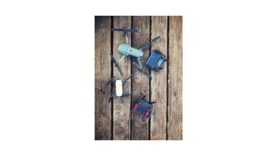
Drones can be divided into two categories: multirotor and fixed wing. Fixed wing drones like the eBee are used for flying large tracts of land. If you are starting out with a mapping business, buying a multirotor is advisable.
Global Shutter vs. Rolling Shutter
Next, you need to understand the difference between a global shutter and a rolling shutter. A global shutter exposes all pixels at the same time. Whereas, a rolling shutter exposes each pixel row, one at a time. So when you are flying a drone with a rolling shutter, image acquisition will be much slower.
This delay in image acquisition can result in distance variation; which ultimately causes image distortion. Drones like the Phantom and Inspire come with a global shutter. Whereas, the Mavic and Yuneec H520 are equipped with a rolling shutter.
To learn more about this comparison, check out our previous blog post, “DJI P 4 Pro vs. Yuneec H520 – Which Is the Better Drone for UAV Mapping?”
So now you have narrowed down your drone search to a multirotor with a global shutter. How do you proceed from here? In simple terms, there are two MAIN considerations for buying the right mapping drone:
- Nature of the job
- Flying environment
Nature of the Job
If you are planning on taking up mapping jobs only, the Phantom 4 Pro is your best option. However, if you wish to take on mapping AND inspection jobs, the Inspire 2 is a better choice. That is because the Phantom 4 Pro does not come with interchangeable lenses. Whereas, the Inspire 2 can fly the X7 camera – which comes with interchangeable lenses.
The downside in using the Inspire 2 rather than the Phantom 4 Pro is that it will eat into your margins. For argument’s sake, let us consider that you are mapping a baseball stadium. You will need 4 Phantom 4 Pro batteries to complete this task. With each Phantom battery costing $150, you will end up spending $600 after four batteries. Whereas, you will end up paying nearly twice that amount on Inspire batteries.
Having said that, production for the Phantom 4 Pro has been stopped by DJI. According to industry speculations, this could be because the Phantom 5 launch is around the corner. If the next Phantom comes with interchangeable lenses, it would undoubtedly be a considerable advantage for drone pilots.
Flying environment
If you are planning on flying in windy or cold conditions, you are better off buying the Inspire 2.
Firstly, the Inspire 2 is a heavier bird. Also, because of uneven weight distribution, the Inspire 2 snaps into safe flight faster than the Phantom 4 Pro and even the Inspire 1. Because of these reasons, Inspire 2 has greater wind handling capability.
Secondly, the Inspire 2 comes with high altitude props and self-heating batteries. That means that you can fly in cold weather too.
Once you gain a firm foothold in the mapping industry, you might wish to take on complex and large-scale mapping jobs. At this point, you might feel the need to upgrade to a large enterprise-level drone. So, which is the best multirotor enterprise-level drone for mapping? Check out our “Comprehensive Mapping” course where we discuss drone selection in great detail.
Step 3. Select the Best Mapping Application
Now that we have talked about hardware, let us talk about mapping software. Mapping software or mapping applications can be divided into three categories:
- Acquisition Software – For Data acquisition
Maps Made Easy, Pix4D Capture, and UCGS
2. Processing Software – Used for creating point clouds, maps, and ortho-mosaics
Pix4D Mapper, Photoscan Agisoft, Inpho
3. All-in-one Software – Cloud-based software
Skycatch and DroneDeploy
Pix4D vs. DroneDeploy
You can customize your maps/models to a far greater extent if you are using a desktop-based application. So, for instance, adding in manual tie points is not possible in a cloud-based application like DroneDeploy. Another limitation of using cloud-based applications is the inability to process voluminous data. Because of the above reasons, we strongly recommend you choose Pix4D as your mapping application.
Apart from DroneDeploy and Pix4D, other mapping applications have some unique benefits. For instance, DJI GS Pro allows you to fly in vertical orbit mode. So, if you are mapping vertical structures like cell towers, GS Pro is an excellent choice.
Maps Made Easy is another excellent mapping application. It is the ONLY mapping application with a terrain awareness feature. This feature can be immensely useful if you are mapping an area with a lot of elevational variances.
Step 4. Invest in Drone Accessories
Apart from investing in a drone and mapping application, you will also need access to a reliable GPS. And you do NOT need to spend thousands of dollars in a high-end GPS. Renting a Leica or Trimble unit is a wise move, especially in the initial stages of your drone business. Check out ADU 954 – What Is the Most Practical and Cost-Effective Workflow for Survey-Grade Drone Mapping? for more insights on this topic.
Our Landing pads with built-in ground control markers and scale constraints, created especially for mappers will help you eliminate the organizational error.
Also, while your drone is up in the air, you will need backup batteries and a way to charge them. Colorado Drone Chargers is an excellent solution that allows you to charge four Phantom 4 Pro batteries at one time.
Check out our “Ultimate Drone Kit” for a complete and comprehensive list of drone accessories.
Become a Drone U Member.
Do not forget to subscribe and Listen to Ask Drone U, the #1 drone podcast.


Add Your Comment