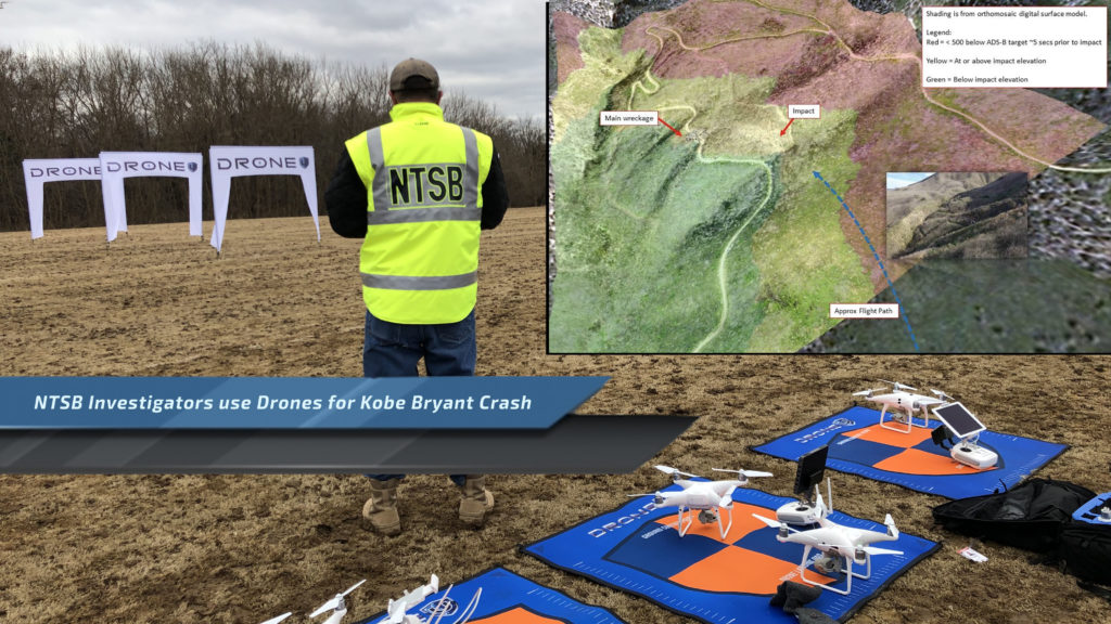
Kobe Bryants crash was investigated and decoded with the help of NTSB Investigators and their drones.
Kobe Bryan’ts helicopter crash, might just have been decoded thanks to drones used by NTSB investigators. During a foggy January morning in California, Kobe Bryant and 8 others tragically lost their lives in a helicopter accident. After months of waiting to learn what really happened, the NTSB has released their final findings. The cause of the crash seems multi-faceted, with a lack of equipment and lack of risk-based decision making.
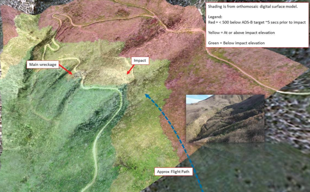
While the cause of the crash may not be important, the tools that were used to help the investigation are extremely important. Drones were used to create a 2D map of the Calabasas crash site. Using terrain awareness, the drone was able to map the hillside to better understand the accident site. Thanks to drone mapping, investigators were able to decode the scene and better discern the flight environment.
It is easy to blame the pilot of that horrible flight. The conditions for flight were subpar, yet the pilot had the rating and experience to navigate the environment. The pilot is the easy scapegoat, especially since pilots subscribe to the ideology that we are ultimately responsible. Albeit the helicopter did not have the right equipment to backup the pilots decisions. Without terrain awareness equipment, the helicopter couldn’t accurately gauge true AGL altitude. Ultimately during the last moments in flight, the pilot became disoriented and struck the hillside killing Bryant, family and friends.
The helicopter flown that dreadful morning was not equipped with a flight data logger either. Without a data logger or terrain awareness system, the pilot was rowing upstream without a paddle.
Terrain awareness systems is an autonomous system that can read the elevation of the terrain and calculate the real time “above ground level” altitude of the aircraft. Garmin manufacturers a system used in tour helicopters and aircraft worldwide. This terrain awareness system would have provided the pilot with crucial information while navigating the fog near the mountain tops. These systems are common in tourist helicopter applications in places like Hawaii.
Get your biggest and most common Part 107 questions answered by claiming your FREE Guide Now!
Investigation | Drones
It is no secret the NTSB investigators use drones to conduct accident investigations and 3d reconstruction. Drones might offer an aerial perspective or birds eye overview of the scene. Drones can recreate of the flight path taken in accident, but that’s not all.

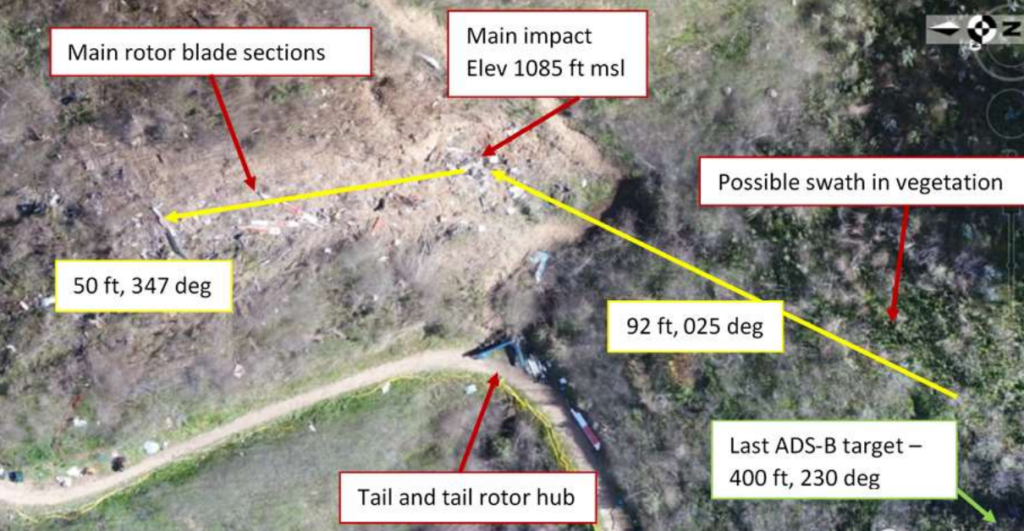
With a precise acquisition method, investigators can utilize these photos to create 2d maps and 3d models. Drones offer investigators a way to digitize the environment. With the scene now frozen in time, they can now take measurements, understand headings and angles…and so much more. Thanks to drones ability to recreate the environment, decoded Kobe’s crash becomes astronomically easier. Creating a 3d model will also helps investigators preserve artifacts and evidence found at the crash site. These 2d maps and 3d models can even be searched with additional software to find important shrapnel unseen by the human eye.
That’s right, drone mapping or photogrammetry was used to help investigate and solve Kobe Bryant’s crash. The processed maps and models can help determine tree strikes, crash patterns and other various environmental factors that may have impacted the accident. Who knew that drone mapping could have such a large impact on the American population.

With their portable size and easy-of-use, drones make it easy and efficient to collect high quality data. Investigators are able to cover more of the accident site at a higher rate of speed than normal. Higher quality data, collected in an efficient and autonomous means… sounds paradoxical right? Drone mapping provides just that, efficient data collection to provide a level of documentation that will help provide answers. Thanks to the help of drones, we can help stop helicopter crashes in the future.
While drones may not have solved the crime unilaterally, Federal investigators count on unmanned aircraft to better discern crash sites and causes. With the right data, we can inhibit these types of accidents from happening again.
Humble Brag: To learn more about our accident reconstruction class, please visit.


Add Your Comment