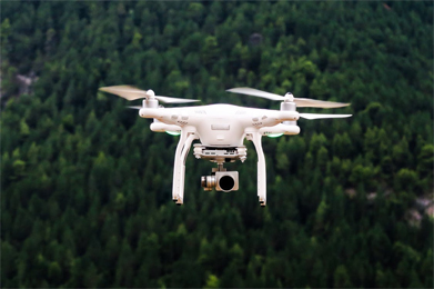
Expert Tips for Building Accurate Drone Maps and Models
Today’s question is about ground truthing your drone maps.
Our caller, Jon from Arizona is a new ADU listener who is learning the nuances of drone mapping. Jon’s question today is about ground truthing. How can you ground truth if you are using a drone like Phantom 4 RTK which relies on a NTrip network? Will your mapping accuracy go down if your NTrip network is not stable?
Additionally, we also discuss the best fixed-wing options and workflow for mapping really large tracts of land. Thanks for the great question, Jon. Fly Safe!
Hone your drone skills by signing up for one of our webinars or online classes – and make the most of this downtime! – https://www.thedroneu.com/droneu-events/
Recently crashed your drone? Unable to find trained technicians who can repair your drone quickly and at a reasonable rate? Don’t fret. The cool folks at Fortress UAV can help you get your drone back up in the air in as little as 7 days! Use Promo Code “DroneU” to get 25% off. Drone U Members get an extra 5% off on total repair costs. Check them out now!
Make sure to get yourself the all-new Drone U landing pad!
Get your questions answered: https://thedroneu.com/.
If you enjoy the show, the #1 thing you can do to help us out is to subscribe to it on iTunes. Can we ask you to do that for us real quick? While you’re there, leave us a 5-star review, if you’re inclined to do so. Thanks! https://itunes.apple.com/us/podcast/ask-drone-u/id967352832.
Become a Drone U Member. Access to over 30 courses, great resources, and our incredible community.
Follow Us
Site – https://thedroneu.com/
Facebook – https://www.facebook.com/droneu
Instagram – https://instagram.com/thedroneu/
Twitter – https://twitter.com/thedroneu
YouTube – https://www.youtube.com/c/droneu
Timestamps
- [00:59] – Today’s question is about ground truthing drone mapping
- [05:04] – How can you ground truth your ground control points if you are using a P4P RTK?
- [07:40] – How can Drone U help you create accurate drone maps and models?
- [09:05] – Which is the best fixed drone for mapping really large areas?
- [10:00] – What are some difficulties that you will encounter when you attempt to map really large areas?
- [10:39] – How drone mapping is helping us tackle serious environmental problems


 Explore more on Drone U


