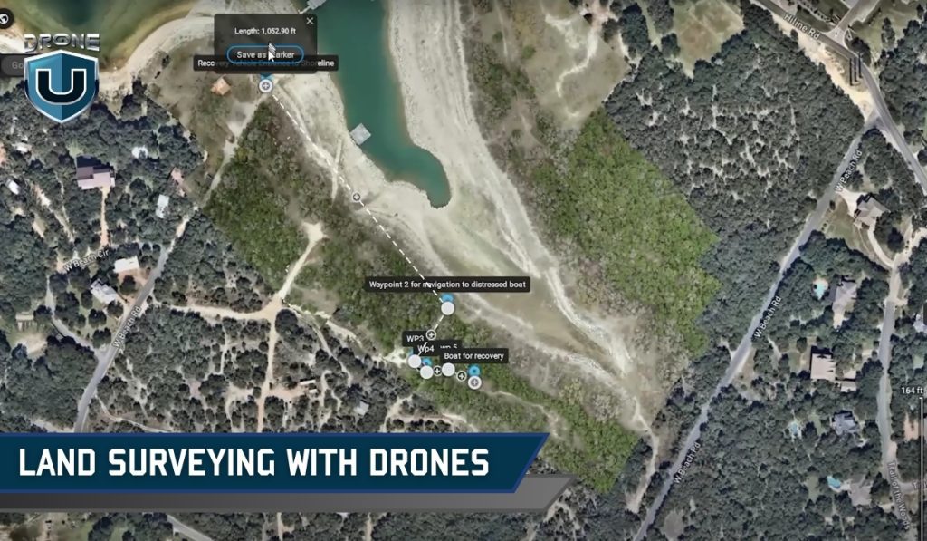
In the past, land surveying was a time-consuming and expensive task. But with the advent of drone surveying, a new era of efficiency and accuracy has begun.
Imagine soaring over vast landscapes, capturing intricate details of terrain with pinpoint accuracy – all at the touch of a button.
Drone surveying has revolutionized how land surveys are conducted, providing previously unimaginable benefits.
In this comprehensive guide, we’ll explore what drone surveying is, its significance, how it works, its benefits, limitations, and various applications.
Disclaimer: In most U.S. states, drone pilots can’t directly offer surveying services. However, drone pilots work for surveyors and provide deliverables that surveyors verify.
Let’s start with the basics.
What is Drone Surveying?
Drone surveying is the process of using a drone (UAV) to capture accurate measurements of land or structures from above.
These drones carry powerful tools, like high-resolution cameras, LiDAR sensors (which use laser light to measure distances), or multispectral sensors (which detect light beyond what our eyes can see).
Together, these tools help capture detailed data about the ground, elevations, buildings, and natural features.
Once the drone collects the data, it’s processed using special software to create maps, 3D models, surface measurements, and even volume calculations.
Surveyors and engineers use this information for land development, construction planning, mining, agriculture, and much more.
Using drones for land surveying feels like leveling up because you’re collecting real, measurable data that professionals can use to build or manage projects.
But here’s where a lot of new pilots get confused…
Drone Surveying vs. Drone Mapping: What’s the Difference?
You’ll often hear people use drone surveying and drone mapping like they are the same. And to be fair, there’s a lot of overlap.
Both use drones. Both involve capturing aerial data. And both rely on photogrammetry software or similar tools to process that data.
But the purpose and output are where things get different.
Let’s break it down:
| Factor | Drone Surveying | Drone Mapping |
| Purpose | The primary purpose of drone surveying is to collect precise spatial data and measurements of terrain, structures, or landscapes. The focus is on obtaining accurate information for analysis, modeling, and decision-making. | Drone mapping is specifically focused on creating detailed maps or orthomosaics of an area using aerial imagery captured by drones. The emphasis is on generating visual representations of the surveyed area for different applications. |
| Data Collection and Analysis | In drone surveying, data collection often involves using specialized sensors such as LiDAR, multispectral cameras, or high-resolution cameras to capture detailed information about the terrain and structures. The collected data are then processed and analyzed to extract specific parameters such as elevation, contours, volumes, or features. | Drone mapping primarily relies on capturing high-resolution images of the surveyed area using drones equipped with cameras. These images are processed to create orthomosaics, which are georeferenced aerial images or 3D models of the terrain. The focus is on visualizing the landscape and identifying patterns or changes over time. |
| Applications | Drone surveying is commonly used in industries such as construction, mining, agriculture, land development, and infrastructure management. | Drone mapping finds applications in areas such as agriculture, forestry, urban planning, disaster response, environmental monitoring, and archaeology. |
So, if you’re working with a licensed surveyor and need exact terrain data to support permits, designs, or boundary work, that’s drone surveying.
But if your goal is to build a map, track crop health, or visualize a project site, you’re probably doing drone mapping.
Of course, in the real world, both are often used together. You might map a construction site visually, then survey it with LiDAR to measure progress or materials.
Significance of Drone Surveying
The traditional way of doing surveys was slow, expensive, and needed a lot of manpower. Drones overcome these challenges by making surveys faster, more accurate, and cheaper.
This new technology has opened doors for surveyors in many fields, like construction, farming, and even archaeology.
Here are five significant factors highlighting the importance of drone surveying:
1. Cost-Effectiveness:
Drone surveying significantly reduces the costs associated with traditional surveying methods. It eliminates the need for expensive manned aircraft or ground-based equipment and requires fewer pilots for data collection, leading to overall cost savings.
2. Time-Saving:
Drones can rapidly cover large areas and collect data more quickly than conventional surveying methods. This time-saving aspect allows for faster project completion, quicker decision-making, and timely monitoring of changes in the surveyed area.
3. Improved Safety:
By minimizing the need for personnel to enter hazardous or hard-to-reach areas, drone surveying enhances safety during data collection. It reduces risks associated with working in challenging environments such as construction sites, mining areas, or disaster zones.
4. High Precision and Accuracy:
Drone technology, coupled with advanced sensors and data processing techniques, enables precise and accurate data collection. This high level of precision is essential for applications such as land surveying, infrastructure inspection, and volumetric measurements.
5. Versatility and Accessibility:
Drones can be equipped with various sensors and payloads to gather different types of data for a wide range of applications. They can access remote or inaccessible areas, providing valuable insights into terrain, infrastructure, and environmental conditions that may not be easily accessible by other means.
Drone surveying makes data collection faster, safer, and cheaper. This helps people in many industries make better decisions. As technology advances, surveying with drones is expected to become increasingly integrated into everyday practices, offering new opportunities for innovation and growth.
With this understanding, let’s walk through how land surveying with drones actually works.
How Drone Surveying Works?
The process of drone surveying typically involves the following steps:
Step 1: Mission Planning
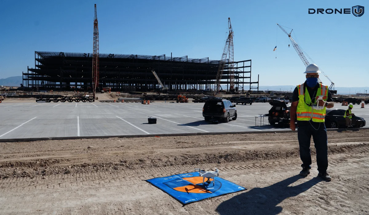
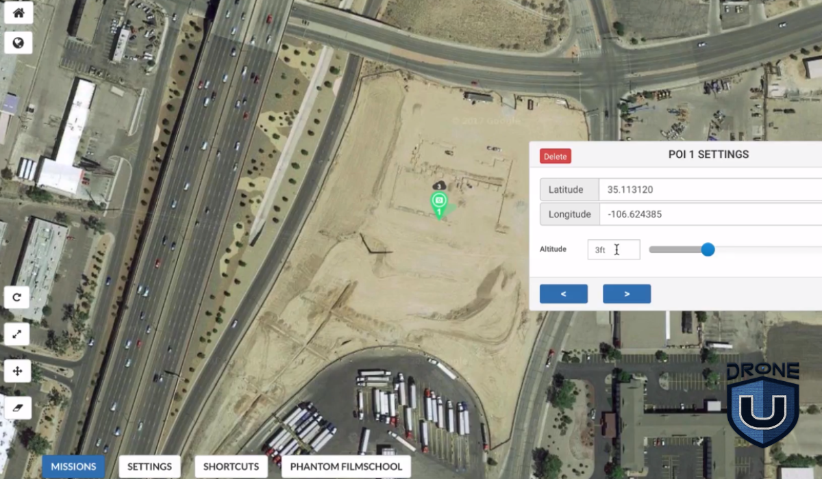
Before the drone flight, surveyors plan the mission by defining the area to be surveyed and determining the flight path and altitude of the drone. The surveyor defines the survey area and sets up ground control points, which are reference points on the ground used to calibrate the drone’s data.
Factors such as the desired level of detail, terrain features, and safety considerations are taken into account during mission planning.
Step 2: Data Capture
Once the mission is planned, the drone is deployed to fly over the designated area while capturing high-resolution images or other sensor data. The drone follows the pre-programmed flight path, ensuring comprehensive coverage of the survey area.
Step 3: Image Processing
Once the images are captured, they are processed using specialized photogrammetry software. This step of image processing involves stitching together individual images, georeferencing them, and creating orthomosaics (georeferenced aerial images) or 3D models of the surveyed area.
Step 4: Data Analysis
The processed data is then analyzed to extract valuable information such as topographic features, elevation data, contours, land cover classifications, or volumetric measurements. Images can be edited and analyzed in software programs to extract valuable information such as height measurements, surface areas, and contour lines.
This information can be used for various applications, including land planning, site analysis, infrastructure design, environmental monitoring, and precision agriculture.
Step 5: Reporting and Visualization
Finally, the results of the drone survey are often presented in the form of maps, reports, or visualizations that provide insights into the surveyed area. These outputs help stakeholders make informed decisions and take appropriate actions based on the survey findings.
Having understood the process, let’s explore the applications of drone surveying.
Applications of Drone Surveying
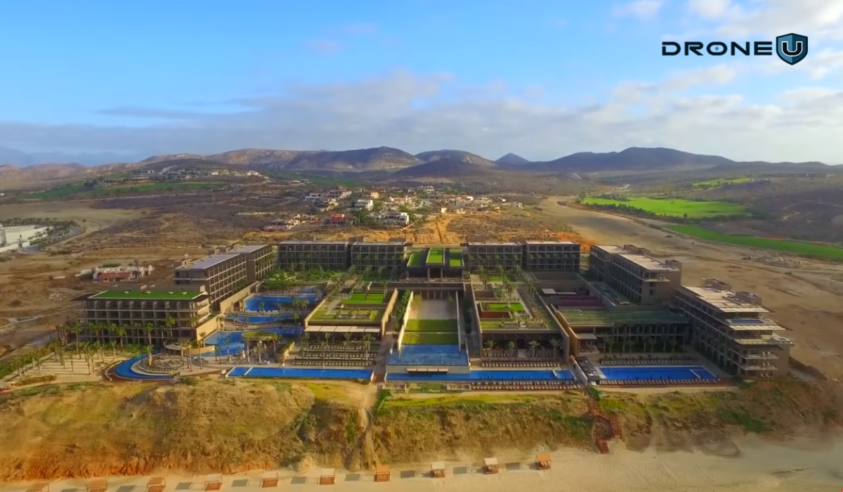
Using drones to gather data has revolutionized surveying by providing a safe, efficient, and cost-effective method.
Watch this video to know if surveying small properties with drones is feasible
Here are some of the industries that have benefited from surveying with drones:
1. Construction
Site planning and progress monitoring: Drones provide aerial imagery that helps visualize site conditions, monitor construction progress, and track changes over time. This allows for better planning, resource allocation, and project management.
Volume calculations and stockpile measurements: Drones equipped with specialized sensors can measure stockpiles of materials like soil, sand, and gravel with high accuracy. It is useful for cost estimation, material management, and progress tracking.
Roof inspections and building condition assessments: Drones can safely access rooftops and capture detailed images to identify potential problems like leaks, cracks, and loose shingles. In comparison with traditional methods, it can save you time and resources.
2. Land Surveying and Mapping
Topographic mapping and terrain modeling: Drones can capture high-resolution aerial imagery used to generate detailed topographic maps and 3D terrain models. These models are essential for land development, infrastructure planning, and environmental studies.
Boundary demarcation and land use planning: Drones provide accurate maps of property boundaries and land use, assisting with land registration, development planning, and environmental impact assessments.
Cadastral surveys and volumetric measurements: Drones can be used for cadastral surveys, which create official records of land ownership. Additionally, they can measure the volume of material in stockpiles or excavation sites.
3. Infrastructure Inspection
Bridges, pipelines, power lines, and communication towers: Drones can inspect critical infrastructure like bridges, pipelines, power lines, and communication towers for damage, wear, and potential safety hazards. It is effective for early detection and rectification of issues, preventing costly repairs, and ensuring public safety.
Identifying damage, wear, and potential safety hazards: Drones equipped with high-resolution cameras and specialized sensors can identify corrosion, cracks, and other structural issues in infrastructure, making repairs and maintenance more timely.
Progress monitoring and maintenance planning: Drones can help you monitor infrastructure construction progress and identify any deviations from the plan. This information helps in timely course correction and ensures efficient project completion.
4. Agriculture
Crop health monitoring and yield estimation: By capturing multispectral images, drones can assess crop health, identify diseases and pests, and estimate potential yield. It helps farmers to take timely and targeted actions to improve crop health and productivity.
Field mapping and irrigation planning: Drones can create detailed field maps, helping farmers in planning and optimizing irrigation systems for efficient water usage.
Precision agriculture applications: Drones are used for targeted application of fertilizers, pesticides, and herbicides, reducing waste and minimizing environmental impact. UAVs also play a role in collecting data for soil analysis and variable rate applications.
5. Other Applications
Mining and quarry surveying: Using drones to map mining and quarry sites, measure stockpile volumes, and monitor blasting operations can improve safety and productivity.
Environmental monitoring and disaster response: Drones are useful for monitoring environmental changes, assessing the impact of natural disasters, and assisting in search and rescue operations. They can also be used for wildlife habitat mapping and conservation efforts.
Search and rescue operations: Drones are useful for finding missing people in hard-to-reach places, saving valuable time and improving rescue chances.
Archaeological surveys and cultural heritage documentation: Drones can capture high-resolution imagery and 3D models of archaeological sites and cultural heritage monuments, allowing for detailed documentation and preservation efforts.
As technology continues to evolve, we can expect even more innovative and efficient uses for drones in various industries in the future.
Let’s understand the pros and cons of surveying with drones.
Pros and Cons of Drone Surveying
Like any tool, drone surveying comes with its strengths and trade-offs.
While it offers speed, safety, and incredible precision, there are still some real-world limitations to keep in mind, like battery life, weather, and flight restrictions.
Let’s take a quick look at the biggest pros and cons, so you can decide if it’s the right fit for your project or business.
| Pros | Cons |
| 1. Drone surveying eliminates the need for extensive manual labor and significantly reduces the time required for surveys. This results in cost savings for surveying projects. | 1. Adverse weather conditions, such as strong winds and rainfall, can hinder drone operations and affect data quality. |
| 2. Drones equipped with advanced sensors and GPS technology can capture highly precise data. The resulting 3D models and measurements are more accurate compared to traditional methods. | 2. Drones have limited battery life, which restricts their flight time and surveying capabilities, especially for larger areas. |
| 3. Drones can access remote or hazardous areas that may be difficult or unsafe for surveyors to reach. This enables surveys in rugged terrains, construction sites, or areas affected by natural disasters. | 3. Drone regulations may limit flight altitudes and distances, or even require drone operators to obtain special permits in some areas. |
Having understood the importance, let’s look at the factors to consider.
Considerations for Surveying with Drones
While the significance of drone surveying is undeniable, several crucial factors require careful consideration before deploying this technology.
Take a look at this video on navigating the surveying industry as a drone pilot
1. Regulatory Landscape:
To maintain legal compliance and avoid any potential safety hazards, you must comply with ever-evolving regulatory landscapes. Obtaining necessary permits and adhering to airspace restrictions are essential. Each area may have its own regulations, so it is important to stay informed about local and national guidelines.
2. Weather Conditions:
In drone operations, the weather plays an important role. During high winds, images may be blurred, and data quality may be compromised.
Rain, snow, and fog can further hinder data collection and pose safety risks. Keeping track of weather forecasts and scheduling flights during optimal conditions is essential.
3. Data Privacy and Security:
Data privacy and security are imperative when capturing and storing sensitive data. It is crucial to implement robust security measures to protect sensitive data, such as adhering to relevant data privacy regulations and using secure data storage practices.
4. Choosing the Right Equipment:
Drones and equipment must be selected according to the specific requirements of the project. The ideal drone type depends on factors such as the size and complexity of the area, the desired data resolution, and the payload requirements (camera, sensors). It is also important to balance budget considerations with equipment capabilities to achieve optimal value.
5. Pilot Experience and Training:
An operation’s success and safety are strongly influenced by the expertise of the drone pilot. An experienced and qualified pilot with rigorous training and relevant licenses is always a plus. Having a thorough understanding of safe flight practices, data collection, and emergency procedures ensures efficient data collection and minimizes risks.
With drone surveying, what kinds of deliverables can you expect? That’s covered in the next section.
Deliverables of Drone Surveying
The specific deliverables you receive will depend on the scope of your project and the agreement with your drone surveying service provider. But here are some generally included:
2D Outputs:
Orthomosaic Maps: These are high-resolution aerial images stitched together to form a single, accurate map. They are geometrically corrected to remove distortion and represent the true scale of the ground. These maps can be used for measuring distances, calculating areas, and creating detailed plans.
Digital Surface Models (DSMs): These are 2D representations of the terrain surface, including vegetation and buildings. They are created by processing drone imagery and provide information about surface elevation.
Contour Lines: These are lines connecting points of equal elevation on a map, creating a visual representation of the topography.
3D Outputs:
Digital Elevation Models (DEMs): Similar to DSMs, DEMs represent the bare earth elevation, excluding vegetation and structures. These are valuable for analyzing terrain, calculating volumes, and engineering design.
Point Clouds: These are dense collections of 3D points representing the location and elevation of objects on the ground. They provide a highly detailed representation of the surveyed area and can be used for various applications like environmental assessments, monitoring, and leak detection.
3D Models and Animations: These are detailed digital representations of the surveyed area in 3D. They can be used to create fly-through animations and virtual tours, providing a realistic and immersive view of the site.
Additional Deliverables:
Progress Reports: In some cases, drone surveying companies may provide progress reports throughout the project, updating clients on data collection and processing stages.
Data Files: Depending on the project requirements and agreement, raw data like captured images and processed point clouds might be delivered to the client.
Watch this video to find out if providing drone services to surveyors is worth it
Conclusion
Drone surveying has emerged as a game-changer, offering a safe, efficient, and cost-effective way to gather data across diverse industries.
Looking ahead, the future of drone surveying is brimming with potential. Technological advancements in sensors, data processing, and autonomous flight capabilities are constantly pushing the boundaries of what this technology can achieve.
We can expect even wider adoption and integration with other cutting-edge technologies like AI and machine learning.
Check out this page to learn about our exclusive training programs and become a certified drone pilot.
Frequently Asked Questions
Q1: Are there any legal requirements for operating drones for surveying purposes?
Yes, operating drones for commercial surveying purposes may require permits, licenses, or certifications. It is important to be aware of and comply with the regulations specific to your country or region.
Q2: How accurate are the measurements obtained from drone surveying?
Aerial surveying can achieve high accuracy levels, often within a few centimeters. However, accuracy depends on various factors such as the camera quality, the drone’s positioning system, ground control points, and image processing quality.
Q3: Can drones be used in areas with limited GPS coverage?
Yes, drones equipped with advanced technologies like RTK (Real-Time Kinematics) or PPK (Post-Processed Kinematics) can operate in areas with limited GPS coverage by relying on ground control points or additional positioning systems.



Add Your Comment