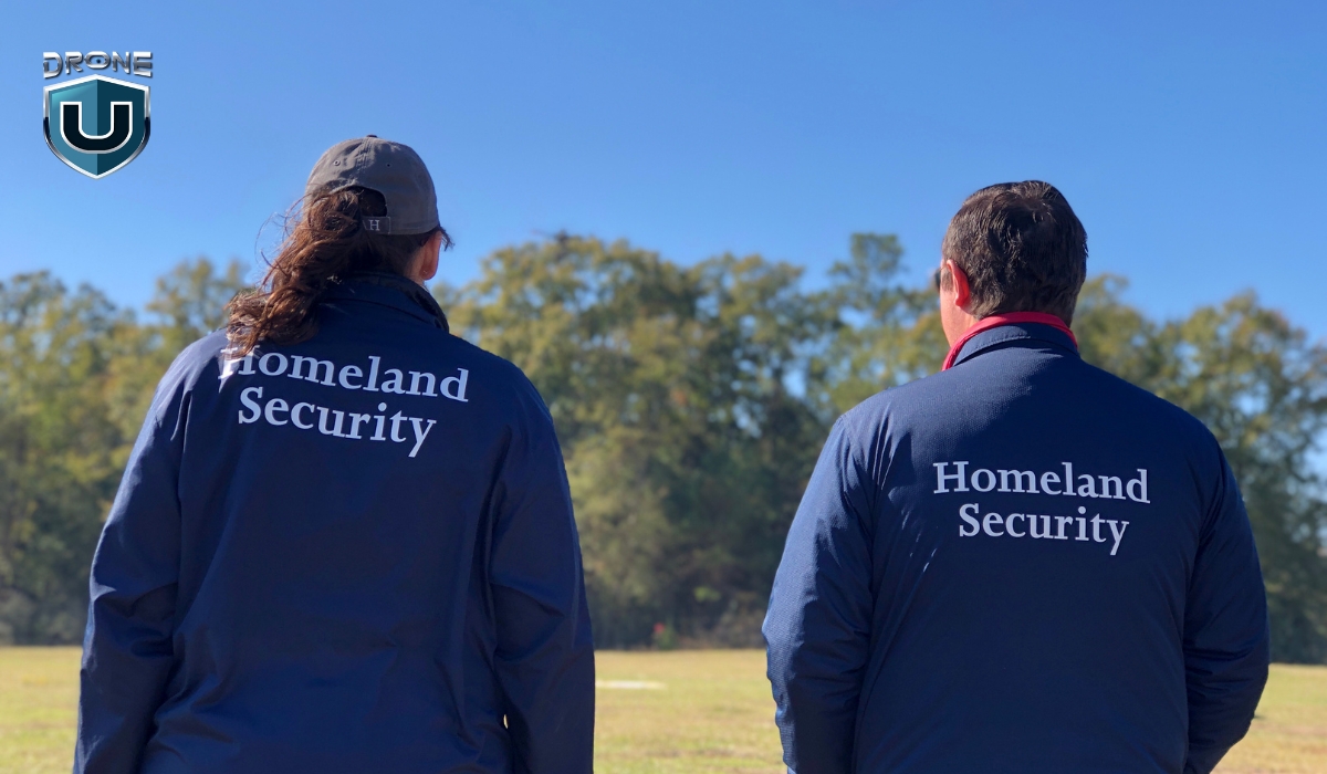
![Drones and Public Safety: Top Models, Use Cases, & Trends [2025]](https://www.thedroneu.com/wp-content/uploads/2025/04/Public-Safety-and-Drones-1024x597.jpg)
When every second matters, drones come into play as a lifeline. The global public safety drone market is projected to hit $9.9 billion by 2033, growing at a 15.7% CAGR. This clearly reflects how essential drones have become to modern emergency response.
According to a research article from ahajournals.org, drones could cut the 90th percentile of AED arrival times by more than six minutes in urban areas and over ten minutes in rural areas.
With their ability to provide real-time footage, drones are fast becoming an essential tool for first responders. Given these powerful benefits, it’s clear why drones have quickly become indispensable in public safety operations.
You might be wondering, how exactly drones are transforming public safety.
In this article, we’ll explore how drones are reshaping public safety and emergency response. We’ll also talk about how to become a drone pilot in public safety and uncover some of the top drone models used in this field.
Let’s explore the adoption of drones for public safety first.
Evolution and Adoption of Drones in Public Safety
The idea of unmanned flight dates back to 1849, when Austrian forces launched balloons filled with explosives against Venice.
For most of the 20th century, militaries used drones mainly for reconnaissance and combat missions.
That has changed in recent decades.
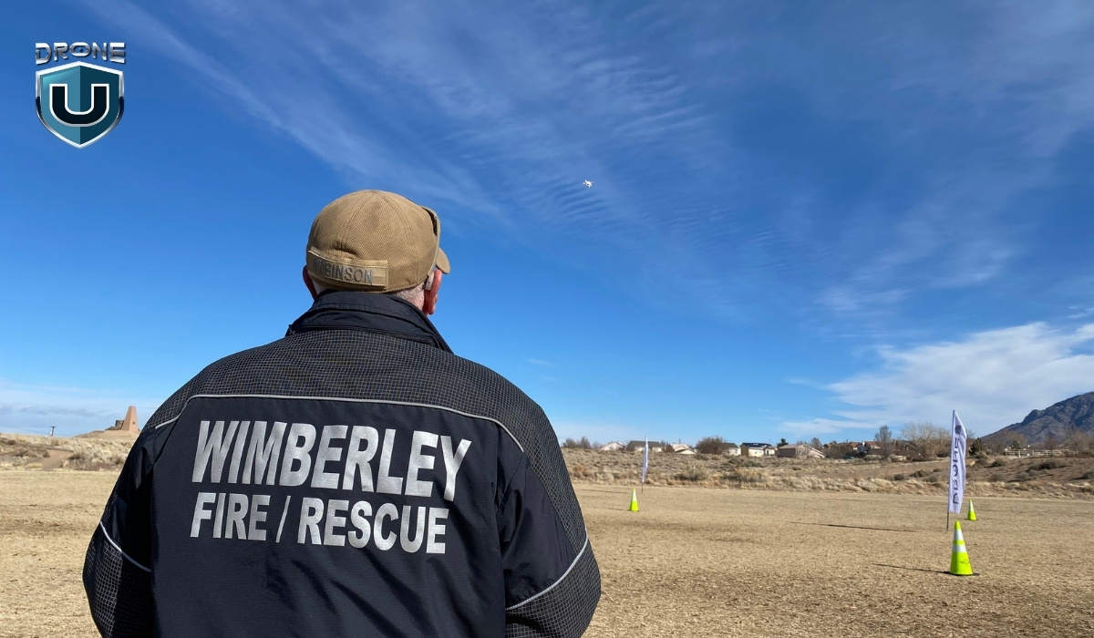
Nowadays, drones play a vital role in civilian applications, especially in public safety. Fire departments, law enforcement, and emergency response teams rely on drones to gather real-time data, monitor dangerous areas, and respond faster.
How are Drones Used in Public Safety Operations?
As Chief Colin Stowell of the Los Angeles Fire Department put it, “Time saved by drones can mean lives saved.”
From helping first responders to improving security to saving lives in search and rescue operations, drones are transforming the public safety landscape in a big way.
Here’s how drones play a key role in different public safety operations:
1. Search and Rescue
During emergencies, every second counts. Drones can cover large areas quickly, providing real-time aerial views. UAS helps locate missing persons, assess hazards, and even drop life-saving supplies in hard-to-reach areas.
Search and rescue operations have come a long way. You now use coordinated search patterns to cover areas efficiently and thermal drones to detect heat signatures. Like in a recent case where a missing hiker in California was found using thermal imaging.
With AI, you can even scan drone images to spot objects or signs that might point to where a person is. It’s a powerful combination of tech making a real difference.
2. Traffic Accident Reconstruction
When accidents occur, drones are used to document the scene. Their ability to capture high-definition aerial footage allows investigators to reconstruct the scene quickly.
It’s also important to note that shutting down a highway for an hour costs the government up to $1 million for reduced travel.
In addition, with drone-based scene reconstruction, you remove the human element. You can prove velocity, showcase fault easily without argument, and back it all up with data.
You can even recreate the entire scene in virtual reality (VR) to see exactly how it all transpired. You can analyze vehicle trajectories and assess damage from different angles.
This helps speed up investigations, reduce road closures, and improve traffic management during incidents.
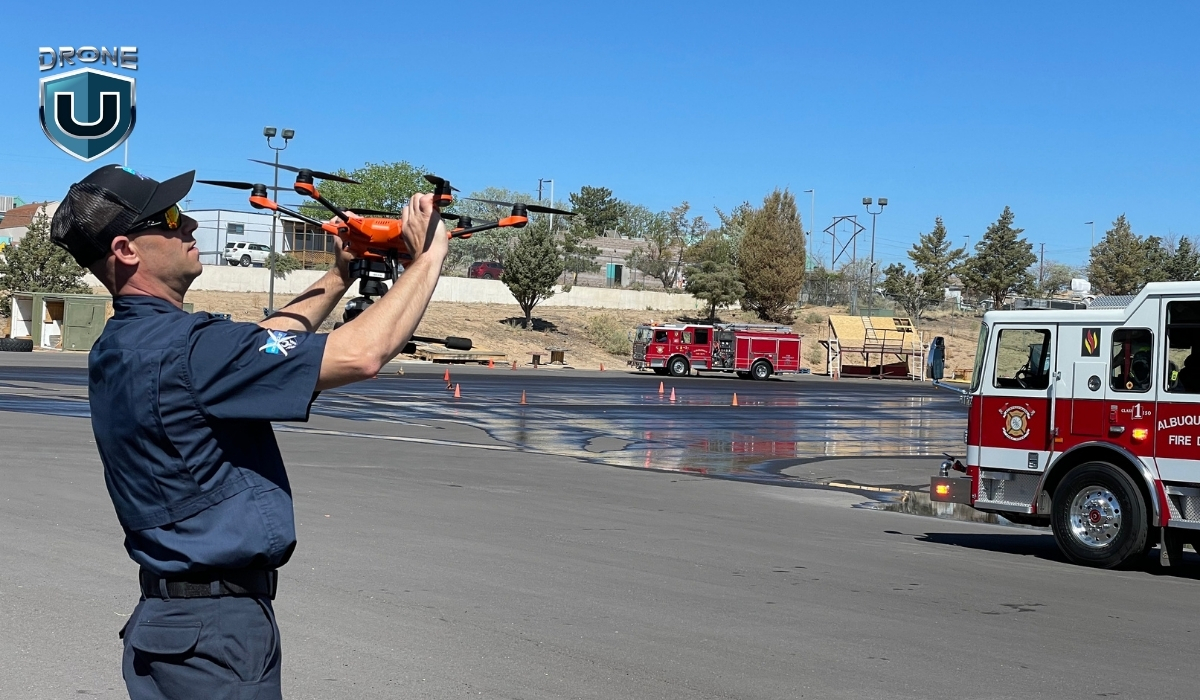
3. Drones as First Responders
In certain situations, drones are now the first on the scene, arriving faster than human responders. Drones equipped with cameras and thermal sensors can assess situations in real time and relay critical information back to the command center.
This helps in delivering first aid supplies faster. It gives emergency teams a head start, enabling them to respond more effectively when they arrive. The New York Police Department’s “Drone as First Responder” program deploys drones to sites of reported robberies and gunshots, offering immediate situational awareness.
We’ve seen this play out in real-world disaster zones like the recent aftermath of Hurricane Helene. Drones were deployed across hard-hit regions in the Southeast, including Florida, Tennessee, and North Carolina, supporting search and rescue missions, surveying storm damage, and even inspecting damaged bridges.
In some cases, drone teams created digital twins of key infrastructure to help city engineers assess safety and accelerate repairs.
4. Large Events and Campus Security
Drones help monitor large public gatherings, such as concerts, protests, and sports events. They provide a bird’s-eye view of crowds, detect potential threats, and track movements.
Drones are also being used to patrol large areas on university campuses, enhancing security by covering more ground efficiently.
They’re also becoming a vital tool in emergency planning. For example, Empower Field in Denver was mapped by drones to better understand how to navigate the stadium in case of an emergency.
A detailed and centralized map of the area helps emergency teams plan faster routes. This information can literally save lives for emergency personnel.
5. Protecting Privacy
While drones are useful for surveillance, they also help ensure privacy in public spaces. With drones, law enforcement agencies can monitor crowds and public areas without relying on fixed cameras, offering a less intrusive way to ensure public safety.
Drones are also used for enforcing privacy laws, preventing unlawful surveillance, and protecting individual rights. For instance, the New Orleans Police Department deployed drones during a critical incident on June 9, 2024, enhancing their response capabilities.
But how can you start as a public safety drone pilot? Let’s explore the essential certificates.
Which Certificate Do You Need for Public Safety Drone Operations?
For flying drones for public safety operations, consider taking up a Part 107 license and/or the COA (Certificate of Authorization).
Watch this video to have a better understanding of both certificates:
Let’s dive into each of them:
1. Part 107 License (Remote Pilot Certificate)
For any commercial or public safety drone operations, the Part 107 license is a must-have. This certification ensures that the operator understands safe flight practices, airspace regulations, and emergency procedures.
The Part 107 Certification is issued by the Federal Aviation Administration (FAA) and is the standard certification for commercial drone operators in the United States.
Key Requirements:
- Eligibility: To obtain a Part 107 Certificate, you must be at least 17 years old, be able to read, speak, write, and understand English, and be in a physical and mental condition to safely operate a drone.
- Knowledge Test: You must pass the FAA’s Knowledge Test (often referred to as the FAA Part 107 Test), which covers topics like:
- Airspace classifications and restrictions
- Weather effects and drone operations
- Drone maintenance and safety protocols
- Emergency procedures
- Flight Operations: A Part 107 Certificate allows you to operate drones in most scenarios, including commercial and public safety operations. This includes:
- Daytime operations (within visual line-of-sight)
- Drone weight limit up to 55 pounds (including any payload)
- Renewal: The Part 107 certificate is valid for 24 months and must be renewed with a recurrent knowledge test.
2. COA (Certificate of Authorization)
The Certificate of Authorization (COA) is issued by the FAA for agencies or entities like law enforcement or fire departments that want to conduct public safety drone operations beyond the restrictions of the standard Part 107 rules.
Key Requirements and Details:
- Special Operations: The COA is required for government and public safety agencies that need to perform drone operations in restricted airspace or beyond the typical Part 107 guidelines. These can include:
- Flights over people or at night (Part 107 typically doesn’t allow these without a waiver).
- Operations in controlled airspace or near airports without Part 107 waivers.
- Process: To obtain a COA, public safety agencies must apply directly to the FAA, specifying their operational needs and demonstrating their ability to safely manage drones. The application process includes:
- Detailed operational plans
- Safety protocols
- Risk management strategies
- Approval for Specific Operations: The COA is specific to the organization and the type of operations it plans to carry out. For example, a fire department might apply for a COA to operate drones for fire mapping or search and rescue in restricted airspace.
For public safety agencies, the COA allows the agencies to operate beyond the limitations of Part 107. If you’re conducting operations that involve flying drones at night, over large crowds, or in restricted or controlled airspace, you’ll need a COA.
Summary of Key Differences
| Feature | Part 107 License | COA (Certificate of Authorization) |
| Issued By | FAA | FAA (specifically for public safety agencies) |
| Eligibility | Available to individual drone operators | Available to government/public safety agencies |
| Scope of Operations | Standard commercial operations within Part 107 rules | Allows for operations outside Part 107 limits, e.g., night flying, flying over people |
| Required for | Any commercial or public safety drone use | Public safety agencies seeking extended flight privileges |
| Duration | 2 years (requires renewal) | No set expiration; valid as long as the operation is active |
| Required for | Most public safety drones (unless COA is needed for specific exemptions) | Agencies performing high-risk, non-standard operations (night, controlled airspace, etc.) |
With this knowledge, let’s explore what drones you can use for public safety operations.
Best Public Safety drones in 2025
Based on our research and tests, here are some of the best drones for public safety operations:
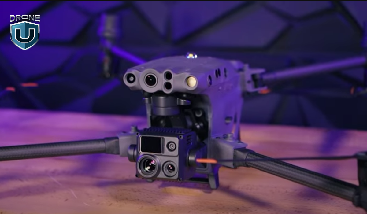
1. Skydio X10
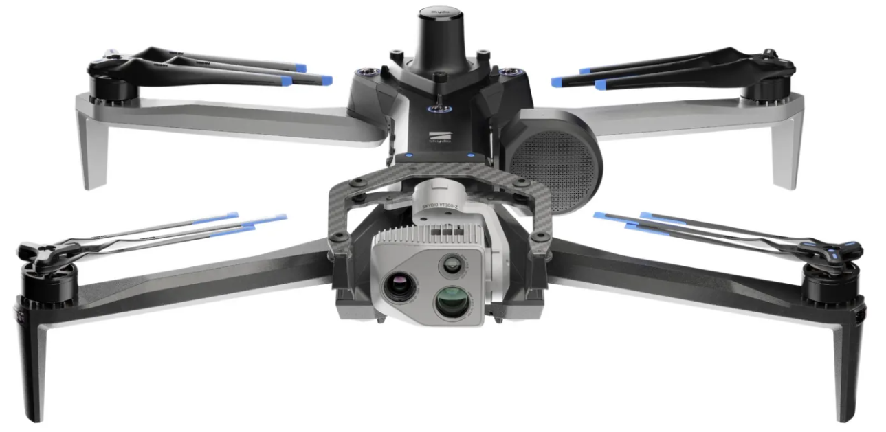
The Skydio X10 is built for professionals who need serious data fast. It’s small, smart, and packed with some of the best sensors you’ll find in a drone this size.
Its modular camera system gives you high-resolution visual and thermal imaging so you can capture exactly what you need.
The Skydio X10 is the first drone to pack a Teledyne FLIR Boson+ sensor, offering sharp thermal visuals with resolutions up to 640×512 and impressive sensitivity.
Key Features of Skydio X10
- Max Flight Time: 40 minutes
- Thermal Imaging: FLIR Boson+ uncooled VOx microbolometer for sharp and sensitive thermal visuals
- Resolution: 640×512 with ?30mK sensitivity for accurate radiometric readings
- Telephoto Camera: 1/2″ 48MP CMOS, great for spotting objects from a distance
- Wide Camera: 1″ 50.3MP CMOS, ideal for capturing large scenes in high detail
- Narrow Camera: 1/1.7″ 64MP CMOS, perfect for zoomed-in, detailed inspections
- Navigation Cameras: 6 cameras
- Weight: ~2.1 kg
- IP55 rating: resistant to dust and water spray
- Operating Temperature: -20°C to +45°C (-4°F to 113°F)
- Obstacle Avoidance: True 360°
- Navigation: GPS, Galileo, GLONASS, and BeiDou
Pros:
- Exceptional autonomous navigation.
- Reliable thermal camera for night or low-visibility operations.
- Ideal for tight spaces and complex environments.
- Compact and portable for quick deployment.
Cons:
- Limited range compared to some other drones.
- Comes with a higher price tag.
- At around 4.7 lbs with batteries, it’s heavier than many drones.
Why Choose Skydio X10 for Public Safety?
The Skydio X10 is perfect for operations in environments where autonomous flight is required, such as dense urban areas or forests. It’s particularly useful in search and rescue operations and situations where real-time obstacle avoidance is a priority.
2. Brinc Lemur 2
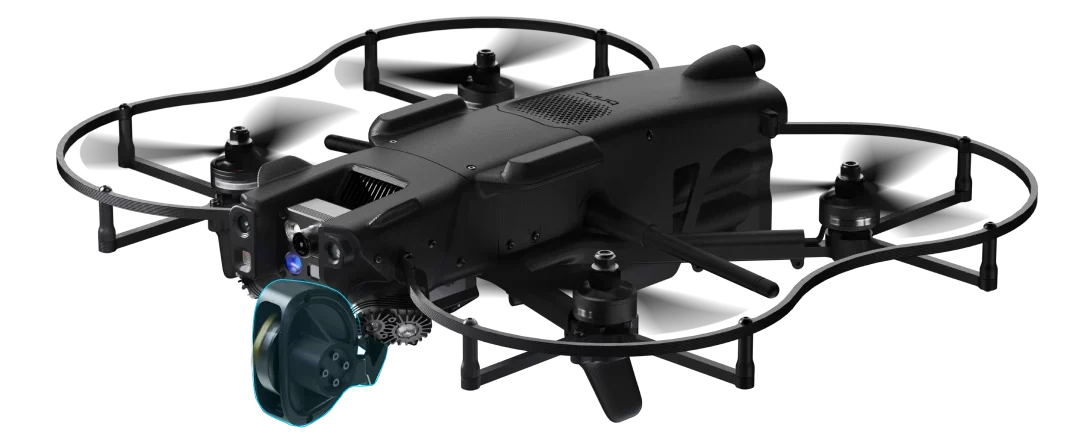
The Brinc Lemur 2 is an NDAA-compliant, American-made drone. It is designed specifically for law enforcement and public safety missions. It is known for its rugged design and ability to perform close-quarter operations, making it ideal for SWAT teams and emergency response units.
Key Features of Brinc Lemur 2
- Max Flight Time: 20 minutes
- Takeoff Weight: 3.3 lbs / 1.5 kg
- Sensor Effective pixels: 13MP
- Thermal Camera Sensor: FLIR Lepton, 160×120
- Max Speed: 48 mph
- Operational temperature: – 4°F to 113°F (-20°C to 45°C)
- Flight Modes: Position Hold, Altitude Hold, Manual
- Water Resistance: Light rain
- Autonomy Sensors: Forward LiDAR mapper, dual forward tracking cameras, and downward LiDAR altimeter
Pros:
- Rugged and durable design suited for tactical operations.
- Two-way communication for direct interaction in sensitive operations.
- Capable of flying in tight spaces and through windows.
- Thermal and optical cameras for all-weather operations.
Cons:
- Limited range compared to larger drones.
- Smaller payload capacity may limit additional sensor integration.
Why Choose Lemur 2 for Public Safety?
If you need a drone for high-risk tactical operations where flying in tight spaces is required, the Brinc Lemur 2 is a perfect choice. Its two-way communication system enhances situational awareness and allows law enforcement to manage operations effectively.
3. DJI Matrice 30T
The DJI M30T is what happens when power, precision, and portability come together in one drone. It’s compact enough to carry easily but packed with features that make it perfect for serious work in public safety, inspections, and emergency response.
Equipped with wide, zoom, and thermal cameras, along with a laser rangefinder, the M30T gives you a complete picture from the air.
The drone uses dual-vision and ToF sensors on all six sides to detect obstacles, while an onboard ADS-B receiver alerts you to nearby crewed aircraft.
With O3 Enterprise Transmission and DJI’s Cellular Dongle, the M30T delivers reliable 1080p live video even in complex or signal-challenged environments.
Key Features of DJI Matrice 30T
- Max Flight Time: 41 minutes
- Compact and portable design
- Folded drone dimensions: 365×215×195 mm
- Total weight (with two batteries): approx. 3.77 kg
- Compatible with GPS, Galileo, BeiDou, and GLONASS (GLONASS requires RTK module)
- Operating Temperature Range: -20°C to 50°C (-4°F to 122°F)
- Zoom Camera: 1/2″ CMOS sensor, 48MP for detailed close-ups
- Wide Camera: 1/2″ CMOS sensor, 12MP for broader scene capture
- Thermal Camera: Uncooled VOx Microbolometer for heat-based imaging
- FPV Camera: Full HD (1920×1080) resolution for pilot view
- Forward Obstacle Sensing: Detects obstacles from 0.6 to 38 meters
- All other directions Obstacle Sensing (up, down, sides, back): 0.5 to 33 meters
Pros:
- Exceptional flight time and long-range capability.
- High payload capacity for a variety of sensors.
- Versatile with multiple camera and sensor options.
Cons:
- The 12MP wide-angle camera may not provide enough detail for high-precision mapping.
- The DJI Pilot 2 app offers basic automation but lacks depth and flexibility.
- Features like Point of Interest (POI) or Orbit are not available.
Why Choose M30T for Public Safety?
The DJI Matrice 30T is ideal for public safety agencies requiring long-range operations. It’s excellent for search and rescue, crime scene investigation, and disaster response, where the ability to carry multiple sensors is paramount.
4. Freefly Systems Astro Max with thermal and LRF
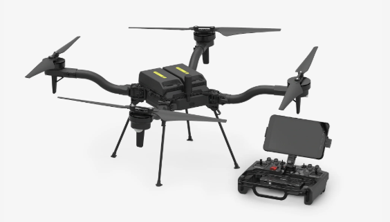
The Astro Max is Freefly’s latest leap into the commercial drone space. It is Blue UAS and NDAA compliant and built with serious work in mind.
This compact industrial drone comes fully loaded with Sony’s LR1 sensor, Pilot Pro controller, Doodle Labs radio, RTK, and LTE cloud connectivity.
What really sets Astro Max apart is its modular payload setup. With a decade of experience flying cinema-grade cameras on major productions, Freefly knows how to engineer drones that carry precious payloads with precision and confidence. Astro Max brings that same reliability to commercial, public safety, and industrial missions.
Key Features of Freefly Astro Max
- Max Flight Time: 39 minutes (28 minutes with LR1 Payload)
- 3kg max payload capacity
- High-resolution rockers for smooth gimbal/camera control
- Pilot Pro Controller comes with an Emergency kill-switch for immediate shutdown
- Astro uses two SL8-Air batteries per flight
Pros:
- Heavy-lift capabilities for a wide range of sensors.
- Decent flight time with a high payload.
- Trusted for sensitive government and public safety operations in the U.S.
- Comes with a durable, drop-tested, submersible travel case
- Designed with open interface specs, allowing teams to integrate custom systems or software.
Cons:
- Expensive and overkill for simpler operations.
- Requires expert piloting skills due to its size and complexity.
- LTE modem works in the United States only.
Why Choose Astro Max for Public Safety?
The Astro Max is ideal for large-scale missions where carrying heavy payloads is required. It’s a great option for operations involving mapping, surveying, or disaster relief where high-powered sensors need to be deployed.
5. DJI Matrice 4T
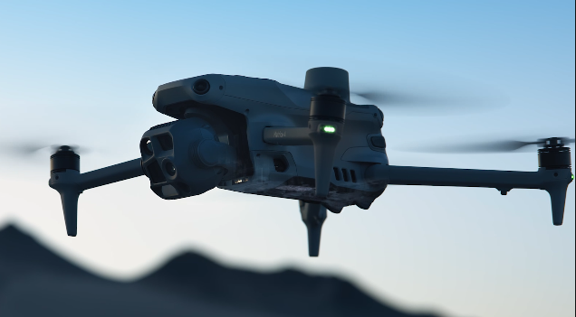
The DJI Matrice 4 Series brings a fresh wave of innovation to the enterprise drone space.
The Matrice 4T is your go-to for public safety, emergency response, and utility inspections. It’s packed with smart sensors, powerful tracking capabilities, and a laser rangefinder that lets you pinpoint and measure with incredible accuracy. It can detect vehicles, vessels, and people mid-flight, making it a game-changer for urgent and high-stakes scenarios.
Key Features of DJI Matric 4T
- Max Flight Time (without wind): 49 minutes (with standard propellers)
- Total Weight (with propellers): 1220 g
- Max Payload: 200 g
- Wide-Angle & Medium Tele Camera: 1/1.3? CMOS, 48MP
- Tele Camera: 1/1.5? CMOS, 48MP
- Laser Range Finder Measurement Range: 1800 m
- Infrared Thermal Camera: Resolution 640 × 512
- Thermal Imager: Uncooled vanadium oxide (VOx)
- Operating Temperature: -10? to 40? (14°F to 104°F)
- GNSS: GPS + Galileo + BeiDou + GLONASS
- Obstacle Sensing: Omnidirectional
Pros:
- Ideal for SAR, inspections, or firefighting.
- Detects heat signatures in difficult conditions like smoke, darkness, or remote terrain.
- Integrated NIR auxiliary light enhances visibility in the dark or fog.
- Smart tracking, real-time mapping, and object recognition features speed up workflow.
Cons:
- Comes at a premium price.
- Teams will need proper training to fully leverage the drone’s capabilities.
Why Choose Matrice 4T for Public Safety?
The DJI Matrice 4 Series is perfect for missions that demand precise detection, measurement, and versatility. It’s an excellent choice for public safety, emergency response, and industrial inspections where intelligent tracking, thermal imaging, and real-time data collection are critical.
6. Vantage Robotics Vesper
The Vantage Robotics Vesper is a lightweight, rugged drone designed for rapid deployment in critical situations. Its high-definition camera and thermal capabilities make it perfect for law enforcement and search and rescue operations.
The Vesper drone offers an American-made ISR system that delivers exceptional performance. With extended flight times and superior low-light capabilities, it’s ready to tackle any mission, day or night. The 3-axis stabilized tri-sensor payload ensures crystal-clear imagery in all conditions.
Key Features of Vesper
- Flight time (Shrouded Rotor Set): 32 minutes
- Flight time (Recon Rotor Set): 50 minutes
- Flight speed: 20 m/s / 45 mph
- Operational temperature range: -20° to 45° C
- Visibility: Not visible at 100 meters seen against terrain
- Ingress protection: IP-53 in flight
- Position control sensors: Redundant GNS, GNSS, VIO, and optical flow for position control indoors and outdoors
- Avoidance: Downward facing sonar, front and rear avoidance available as future software update
Pros:
- With up to 50 minutes of flight time using the Recon Rotor Set, Vesper ensures you can cover large areas with fewer recharges.
- Fast enough for quick deployments and effective operations.
- Incredibly quiet, making it ideal for covert missions.
- Ensures compliance with US government security requirements.
Cons:
- Limited payload capacity compared to larger drones.
- Currently, it only has downward-facing sonar, with front and rear avoidance planned as a future software update.
Why Choose Vesper for Public Safety?
If you need a lightweight, highly portable drone for quick deployment in urgent situations like search and rescue, the Vesper is an excellent choice. The combination of high-definition footage with thermal cameras offers flexibility for various public safety missions.
Future Outlook for Drones and Public Safety
We’re just scratching the surface of what drones can do in public safety.
With the integration of AI and machine learning, drones are starting to make decisions on their own navigating environments, detecting threats, and even analyzing footage in real time. This tech helps responders act faster, with better information and less risk.
Additionally, concepts like Urban Air Mobility (UAM) are moving from prototypes to real-world testing.
However, with more capability comes more responsibility.
And that’s where training and policy come in.
Get your team trained and certified with programs designed for public safety professionals. Explore drone training programs for public safety teams.
Final Thoughts
Consider the types of missions you’ll be flying, the payloads you’ll need to carry, your budget, and the level of training your team has.
In public safety, the key to a good drone is how quickly it can be deployed. When every second counts, you need something that can be up and flying fast.
The M30T is the fastest, at about 30 seconds, and the M4T follows closely at 40 seconds.
While the Vesper takes up to 90 seconds to launch. The Skydio X10 can take a few minutes, and the Freefly might need up to 5 minutes.
That being said, the choice will ultimately depend on your specific needs, whether it’s autonomous navigation, tactical operations, precision mapping, or heavy-lift capabilities.
Frequently Asked Questions
1. Is Part 107 License enough for public safety drone operations?
The Part 107 license is a crucial certification for any individual or agency wishing to operate drones commercially, including for public safety operations. However, while Part 107 is necessary, it may not always be enough, depending on the specific mission requirements.
For certain missions, you need additional approvals, such as waivers or a COA.
2. What are the types of law enforcement that can use public safety drones?
Various law enforcement agencies can use drones, including:
- Police Departments: For surveillance, crowd control, search and rescue, and accident reconstruction.
- Sheriff’s Offices: Mainly for search and rescue in large or rural areas.
- SWAT Teams: For pre-raid surveillance and assessing dangerous situations.
- Fire Departments: To assess fire conditions and assist in search and rescue.
- Border Patrol: For monitoring remote areas and detecting illegal activity.
- Federal Agencies: Such as the FBI and DEA for surveillance and intelligence gathering.
3. Why drones are used in public sfatey?
Public safety teams use drones because they deliver real-time data and visuals exactly when it’s needed most.
Instead of sending officers into dangerous situations like active fires or unstable structures, drones can fly in first. They give teams a clear aerial view of the scene, helping assess risks, locate victims, and plan next steps without delay.
Plus, today’s drones have AI built in, which means they can do a lot more in less time. They can gather and process a ton of data quickly, which is a huge advantage when time is critical in emergencies.


 Podcast Question?