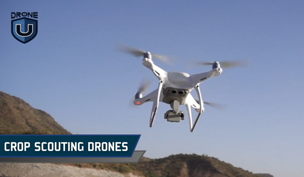
Gone are the days of slogging through muddy fields, squinting to inspect each plant for signs of distress. Modern farming has taken to the skies, embracing cutting-edge technology to revolutionize crop management. Drones have become the data-gathering workhorse and a farmer’s best friend.
Armed with multispectral cameras and sophisticated sensors, drones capture a wealth of insights, translating the unique spectral signatures of plant life into vivid maps and actionable insights.
By integrating drone data with precision agriculture techniques, modern farmers can optimize everything from irrigation schedules to fertilizer applications, ensuring every inch of their fields receives the perfect blend of nutrients and hydration.
In this comprehensive guide, we are going to talk about the top 10 crop scouting drones available in 2024. We’ll delve deep into their features, strengths, and key considerations to help you select the perfect drone for your agricultural needs.
Let’s first understand crop scouting.
What is Crop Scouting?
Crop scouting is the practice of closely monitoring the health of crops in a field. It’s like a checkup for your plants, allowing farmers to identify potential problems before they significantly impact the crops.
Traditionally, crop scouting was done by people walking through fields and making manual observations.
However, technological advancements have led to the use of drones and digital apps to aid in the scouting process.
Here’s a breakdown of what crop scouting entails:
- Monitoring crops: This involves physically going through the field and visually inspecting the plants for signs of trouble. This could include pests like insects, diseases, weeds competing for resources, or nutrient deficiencies.
- Early detection: The key to successful crop scouting is catching problems early. By identifying issues before they spread extensively, farmers can take steps to mitigate them and minimize damage to their crops.
- Informed decisions: The information gathered through crop scouting empowers farmers to make informed decisions. This might involve implementing pest control measures, applying fertilizers to address deficiencies, or adjusting watering schedules.
That being said, let us jump right into the top 10 drones we’ve identified for Crop Scouting.
10 Best Drones for Crop Scouting
Here are the best crop-scouting drones:
1. DJI Mavic 2 Pro
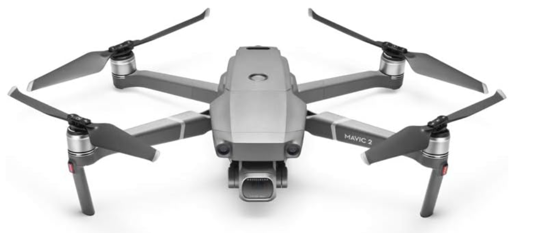
The DJI Mavic 2 Pro is a versatile and high-performance drone that is well-suited for crop scouting. With its advanced camera and sensor capabilities, the Mavic 2 Pro can capture detailed aerial imagery and data to help you closely monitor the health and progress of your crops. Its compact and foldable design makes transporting and deploying in the field easy. The Mavic 2 Pro’s APAS (Advanced Pilot Assistance Systems) technology also enhances its safety and maneuverability, allowing for precise and responsive control during crop scouting missions.
Features of Mavic 2 Pro
| Camera | Hasselblad L1D-20c with 1″ 20MP CMOS sensor |
| Video | 4K HDR 10-bit Dlog-M at 100Mbps |
| Flight Time | Up to 31 minutes |
| Max Speed | 44.7mph (72kph) |
| Obstacle Sensing | Omnidirectional |
| Gimbal | 3-axis for stable footage |
| Intelligent Features | ActiveTrack 2.0, Hyperlapse |
| Remote Controller | Up to 8km 1080p video transmission |
2. Phantom 4 RTK
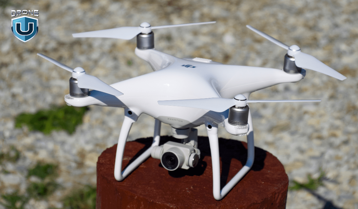
The DJI Phantom 4 RTK is a professional-grade drone specifically designed for precision agriculture applications. Its real-time kinematic (RTK) technology provides highly accurate GPS positioning, enabling you to collect precise data on your crop’s growth, irrigation, and overall condition. The Phantom 4 RTK’s advanced imaging sensors and long-range capabilities make it an excellent choice for large-scale crop scouting operations, providing you with a comprehensive view of your fields.
Features of Phantom 4 RTK
| Application | Surveying, Mapping, Inspection |
| Camera | 20MP 1″ CMOS sensor with mechanical shutter |
| Positioning System | D-RTK 2 (dual GNSS) for high-precision centimeter accuracy |
| Flight Time | Up to 65 minutes |
| Max Speed | 45mph (72kph) |
| Obstacle Sensing | Forward and downward facing obstacle sensors |
| Imaging Modes | Photogrammetry, Waypoint flight |
| Data Collection | Real-time kinematic data for accurate mapping |
3. Matrice 300 RTK
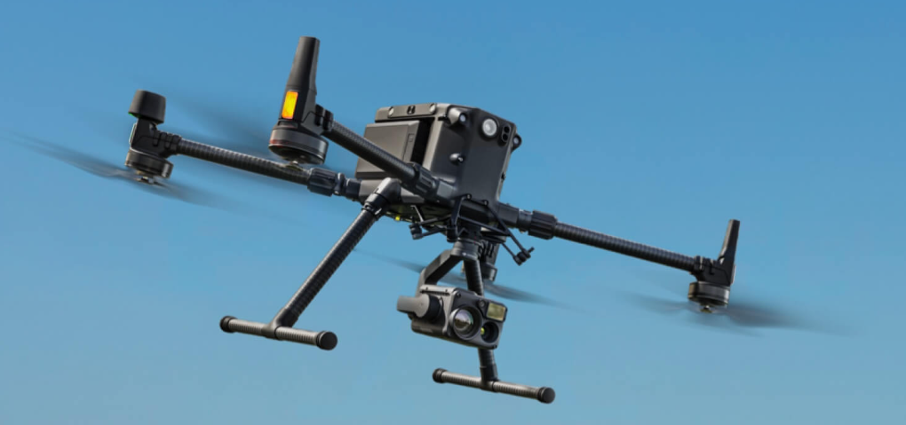
For those seeking a more advanced and enterprise-level solution, the DJI Matrice 300 RTK is a prime choice. This drone features advanced obstacle avoidance, long-range connectivity, and high-resolution imaging capabilities, making it an excellent tool for large-scale crop scouting operations. Its modular design allows for the integration of various payloads to suit your specific needs, such as multispectral cameras or thermal sensors, further enhancing the depth of data you can collect.
Features of Matrice 300 RTK
| Application | Industrial inspection, Search and rescue, Law enforcement |
| Payload Options | Various interchangeable payloads including Zenmuse P1, P2, L1 |
| Camera | Up to 45MP sensor depending on payload |
| Flight Time | Up to 55 minutes |
| Max Speed | 45mph (72kph) |
| Obstacle Sensing | Omnidirectional with six radars and a vision system |
| Intelligent Features | Smart Track, Waypoint 3.0, Terrain Awareness |
| Positioning System | D-RTK 3 for centimeter-level accuracy |
4. Parrot Anafi Ai
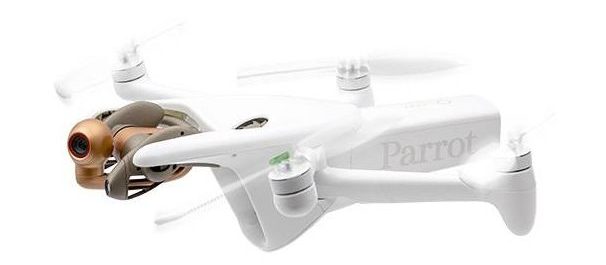
The Parrot Anafi Ai is a rugged and versatile drone that excels in crop scouting applications. With its robust construction, extended flight time, and high-quality camera, the Anafi Ai can capture detailed aerial imagery and data to help you monitor the health and growth of your crops. Its compact size and portability make it a convenient option for on-the-go crop scouting, allowing you to quickly deploy the drone and gather insights in the field.
Features of Parrot Anafi Ai
| Application | Travel, Vlogging, Social media |
| Camera | 4K HDR 21MP sensor with 180° tilt |
| Flight Time | Up to 25 minutes |
| Max Speed | 33mph (54kph) |
| Obstacle Sensing | Front and downward facing obstacle sensors |
| Gimbal | 3-axis for stabilized footage |
| Intelligent Features | AI-powered subject tracking, Automated flight paths |
| Compact Design | Folds for easy portability |
5. Wingtra One
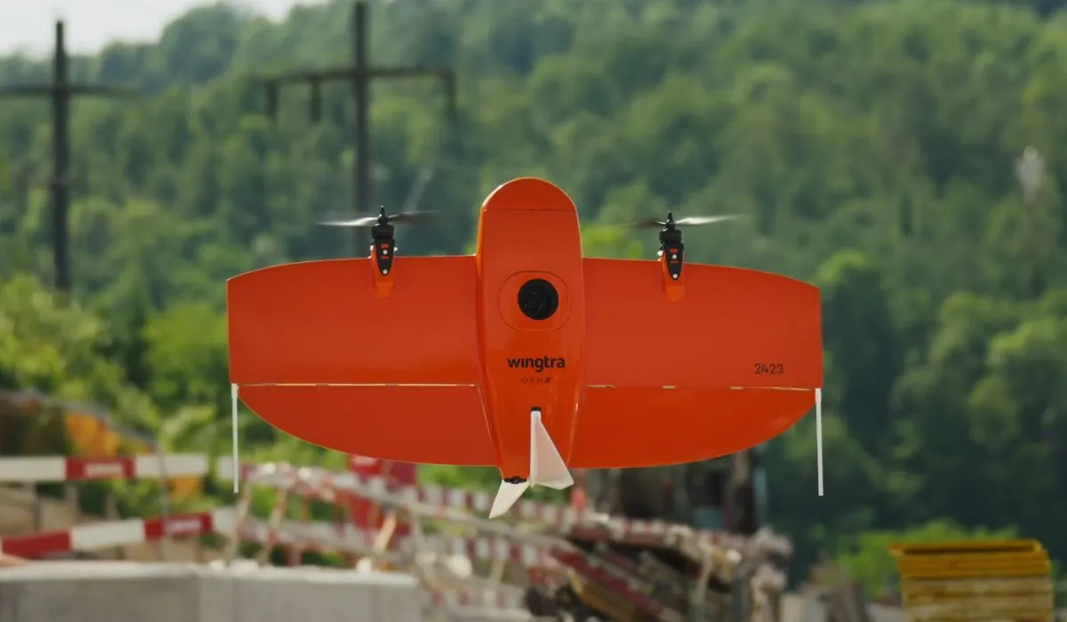
The Wingtra One is a hybrid VTOL (Vertical Take-Off and Landing) drone that combines the benefits of both multi-rotor and fixed-wing designs. This versatile platform offers extended flight time, high-resolution imaging, and the ability to navigate challenging terrain, making it a valuable tool for crop scouting in diverse agricultural settings. The Wingtra One’s stable and precise flight characteristics enable it to capture accurate data, even in windy or uneven conditions.
Features of Wingtra One
| Application | Mapping, Surveying, Precision agriculture |
| Camera | Sony RX1R II with 42MP full-frame sensor |
| Flight Time | Up to 4 hours |
| Max Speed | 44mph (70kph) |
| Vertical Takeoff and Landing (VTOL) | Transitions between vertical and horizontal flight |
| Obstacle Sensing | Downward facing obstacle sensor |
| Imaging Modes | Vertical take-off and landing for detailed data collection |
6. DJI Phantom 4 Pro
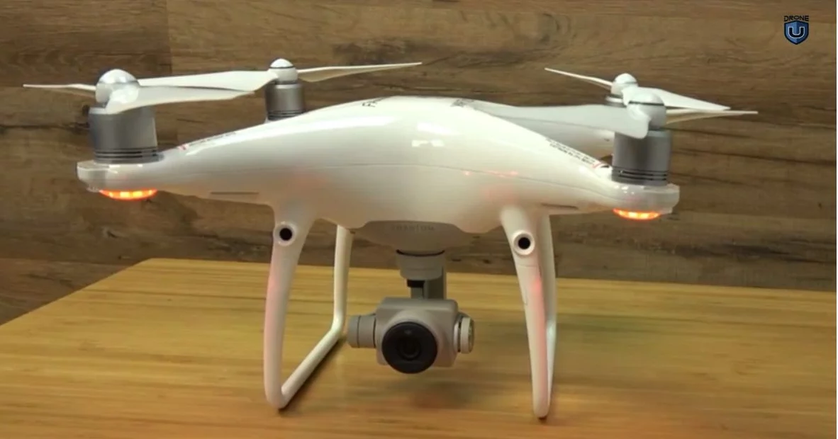
The DJI Phantom 4 Pro can be a handy tool for getting your feet wet in the world of drone-based crop scouting. Its 20-megapixel camera captures detailed images, allowing you to spot issues like pests, diseases, or nutrient deficiencies in your crops from a bird’s-eye view. Plus, the user-friendly controls and automated flight modes make it easy to learn and operate, even for beginners. With a 30-minute flight time, you can cover a respectable amount of ground, gathering valuable data on your crops.
However, the Phantom 4 Pro has limitations for advanced crop scouting. The standard camera doesn’t capture the specific data needed to create NDVI maps, which are crucial for in-depth analysis of crop health. These maps use variations in plant growth detected across different wavelengths of light.
Features of Phantom 4 Pro
| Camera | 1″ 20MP CMOS sensor |
| Video | 4K video at 60fps |
| Flight Time | Up to 30 minutes |
| Max Speed | 45mph (72kph) |
| Obstacle Sensing | Forward, backward, and downward facing obstacle sensors |
| Gimbal | 3-axis for smooth footage |
| Intelligent Features | ActiveTrack, TapFly, Draw |
| Remote Controller | Built-in 5.8 GHz screen for live view (Phantom 4 Pro+ only) |
7. DJI Mavic Air 2
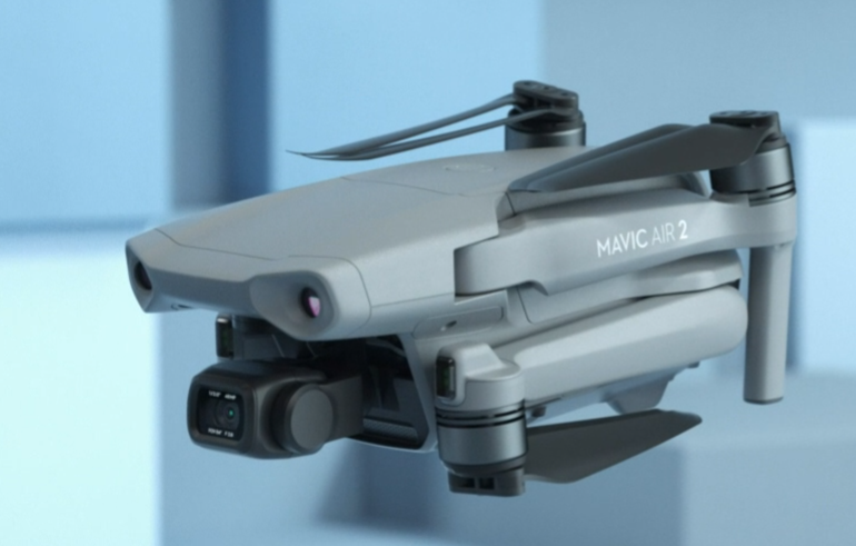
The DJI Mavic Air 2 is incredibly portable. Its folding design allows you to take it anywhere and deploy it quickly in the field. This is a major advantage compared to larger drones that require more setup time and transportation hassles. Additionally, the Mavic Air 2’s camera packs a punch. With its 48 megapixels, it can capture detailed crop images, potentially revealing issues like pests, diseases, or nutrient deficiencies.
The 34-minute flight time is decent for basic scouting missions, allowing you to cover a fair amount of ground.
However, there are some important limitations to consider. Similar to the Phantom 4 Pro, the Mavic Air 2’s camera isn’t equipped to capture data in the specific wavelengths used to create NDVI maps.
The Mavic Air 2 can be a handy tool for getting a basic visual overview of your crops on smaller fields, thanks to its portability, good camera, and decent flight time. However, for professional crop scouting that demands in-depth crop health analysis or requires covering vast areas, a more specialized drone with multispectral imaging and a longer flight time would be a better investment.
Features of Mavic Air 2
| Camera | 1/2″ 48MP CMOS sensor |
| Video | 4K HDR video at 60fps |
| Flight Time | Up to 34 minutes |
| Max Speed | 46.8mph (75kph) |
| Obstacle Sensing | Omnidirectional obstacle avoidance |
| Gimbal | 3-axis for stabilized footage |
| Intelligent Features | QuickShots, FocusTrack, OcuSync 2.0 transmission |
| Compact Design | Folds for portability |
8. Agras T40
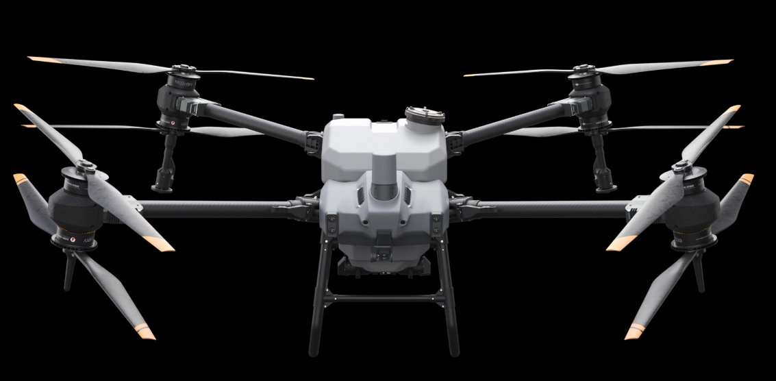
The DJI Agras T40 is a powerhouse agricultural drone designed for spraying, not necessarily scouting. However, its capabilities can indirectly contribute to your crop scouting efforts in a couple of interesting ways.
Firstly, the Agras T40 can be a valuable tool for pre-spraying scouting. Imagine this: before applying any treatment, you can use the T40 to create detailed maps of your entire field. These high-resolution maps provide a bird’s-eye view, potentially revealing problem areas like uneven crop growth or bare patches. With this information, you can then focus your scouting efforts on specific areas that might require more attention.
The Agras T40’s precision spraying abilities also come into play here. Let’s say you use a separate scouting drone (ideally equipped with a multispectral camera) to identify specific areas that need treatment. The Agras T40’s ability to adjust spray application based on location data from the field map allows you to target those areas precisely during spraying. This minimizes wasted product and ensures your treatment reaches exactly where it’s needed most.
Features of Agras T40
| Application | Agricultural spraying |
| Spraying System | 40L tank capacity with eight nozzles |
| Flight Time | Up to 25 minutes |
| Max Speed | 28mph (45kph) |
| Obstacle Sensing | Forward and downward facing radar |
| Intelligent Features | Terrain Adaptive Spraying System, Agras Smart Operating System |
| Autonomy | Automated waypoint flight for precise spraying |
9. P4 Multispectral
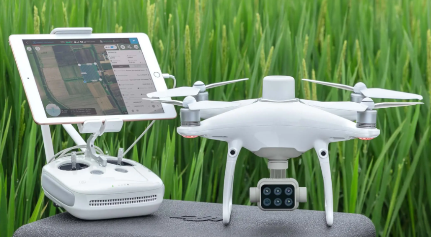
The key advantage of the P4 Multispectral lies in its multispectral imaging capabilities. Unlike regular cameras that capture the visible spectrum of light, the P4 Multispectral delves deeper. It acquires data in specific wavelengths beyond what our eyes can see. This hidden data becomes incredibly valuable when translated into NDVI (Normalized Difference Vegetation Index) maps.
Think of NDVI maps as health reports for your crops. By analyzing the amount of chlorophyll present in the leaves, these maps reveal variations in plant health. Healthy, green vegetation reflects more near-infrared light and absorbs more visible light, resulting in a higher NDVI value. Conversely, stressed plants with less chlorophyll show a lower NDVI value. With this information readily available, you can identify potential problems early on, such as nutrient deficiencies, pest infestations, or diseases.
NDVI maps are game-changers for scouting efficiency. They pinpoint the exact areas within your field that require closer inspection.
Features of P4 Multispectral
| Application | Precision agriculture, Environmental monitoring |
| Camera | Multispectral sensor with six bands |
| Image Data | NDVI, Normalised Difference Vegetation Index |
| Flight Time | Up to 27 minutes |
| Max Speed | 44mph (70kph) |
| Obstacle Sensing | Forward and downward facing obstacle sensors |
| Imaging Modes | Multispectral mapping for crop health analysis |
10. Iotech Agribot Drone
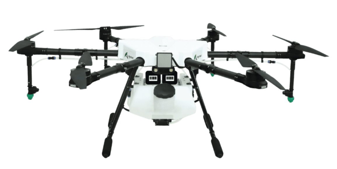
The Iotech Agribot Drone stands out as a strong contender for crop scouting because it offers versatility and features specifically designed for agriculture.
Some Agribot models are equipped with a multispectral camera option, similar to the DJI P4 Multispectral. This powerful technology captures data beyond the visible spectrum, allowing you to generate NDVI maps.
The Agribot boasts a decent flight time, allowing you to cover a significant amount of ground during a scouting mission. This is important for efficiently scouting large fields. Additionally, the Agribot is known for being user-friendly, with features like automated flight paths and data collection software. This makes it easier to learn and operate, even for those who are new to drone technology.
Features of Iotech Agribot Drone
| Application | Precision agriculture, Field scouting |
| Camera | Multispectral or visible light sensor options |
| Flight Time | Up to 20 minutes |
| Max Speed | 31mph (50kph) |
| Obstacle Sensing | Optional obstacle avoidance sensors |
| Intelligent Features | Automated flight paths, Data collection software |
| Compact Design | Folds for easy transport |
Conclusion
The ideal drone for crop scouting depends on your specific requirements and budget.
For beginners or smaller farms, the DJI Mavic Air 2 or Parrot Anafi Ai offers good value with high-resolution cameras and user-friendly controls.
For detailed scouting and data collection, the DJI Mavic 2 Pro, Phantom 4 Pro, or DJI P4 Multispectral provide excellent image quality and some multispectral capabilities.
For larger-scale operations, the Matrice 300 RTK or WingtraOne offer extended flight times and high-precision mapping functionalities, though at a higher cost.
For tasks beyond scouting, like spraying, the DJI Agras T40 is a dedicated agricultural workhorse.
Consider factors like image quality, flight time, ease of use, durability, and payload options when making your decision.


Add Your Comment