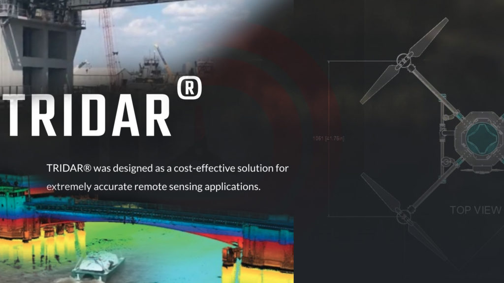
Triad Drones offers a new drone with TRIDAR, a modular LIDAR based system to map and to fly.
Triad Drones, based in Safety Harbor, Florida, recognized a problem with LIDAR drones. Most systems lacked a modular LIDAR system built onto a ready-to-fly drone that consistently worked. In many cases, if you were to purchase a LIDAR mapping drone, you may find that “additional assembly is required.”
With extremely nuanced workflows, existing aerial LIDAR solutions can often remain grounded for nuanced and even simple problems. Triad drones went to the drawing board to engineer a drone that offered clients a turnkey-modular system, but also used LIDAR to assist the aircraft to fly and navigate.
Thanks to the pandemic, Triad Drones launched the Observer drone and TRIDAR system. Manufactured and designed to simplify LIDAR data collection via an aerial platform for TRIDAR. Triad’s goal is simple, to make LIDAR based data collection, processing and overall workflow… much easier.
Modular Drone Mapping with Lidar & Sonar
With a modular TRIDAR system, Triad drones can provide their clients with a turnkey mapping solution. LIDAR, a common payload, used to map the land and penetrate vegetation for bare earth models. LIDAR provides mapping in areas that photogrammetry can’t serve.
LIDAR based drone mapping can often be difficult to produce point clouds. It can be even more difficult to merge photomosaics over LIDAR data to create life like models. TRIDAR system is turnkey for data collection and processing that offers a scalable workflow. Drone teams should be able to more effectively collect and process data in the field.
The TRIDAR platform is more than just LIDAR mapping from the sky. Triad drones, with experience in hydrographic mapping, wanted a system that could float and be flown. TRIDAR can be flown from the Observer aircraft, but can also be used to map the base of a bridge via boat. Triad’s newest quadcopter drone doesn’t just fly lidar, it is flown with LIDAR based assistance.
Drone built around a laser.
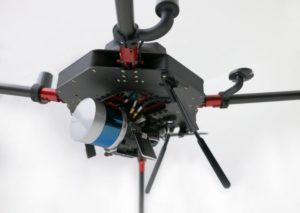
Triad Drones Observer Quadcopter mounted with TRIDAR®, Velodyne VLP32C, NovAtel RTK GNSS, Sony A6000, 4G LTE modem, to provide turnkey life-like point clouds.
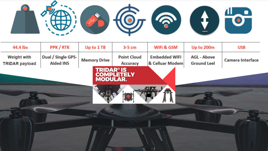
“We built a drone around a laser platform,” says Triad Drones CEO Walter Lappert. The Observer drone utilizes DUAL RTK GPS units, secondary downward facing LIDAR and optical flow for navigation and heading. The Observer drone takes flight with a single beam, laser range finder to implement a proprietary terrain awareness system. Pair the range finder with an optical flow sensor, and now you have more accurate guided navigation with a drone.
Yet, the Observer drone mounts the TRIDAR system in a non-traditional method. Surrounded by traditional “vibration isolation boards,” the TRIDAR system is tucked into the belly of the aircraft. This location offers increased protection and better center-of-gravity to increase flight stability.
The TRIDAR system is capable of using different LIDAR head units to match various budgets. TRIDAR is compatible with units like Velodyne, RIEGL, Ouster, LIVOX, Teledyne and other scanners. The TRIDAR system pairs an Inertial Labs GPS-aided inertial navigation system with NovAtel’s dual antenna(s) GNSS receiver for more accurate collection.
The LIDAR system utilizes SONY mirrorless camera to add life like features to the point cloud. While the workflow of producing life-like data sets might be cumbersome, TRIDAR aims to nix the problem with a turnkey software solution. Triad built the solution because Clients came complaining of the lack of service from other distributors.
The Observer aircraft was designed to simplify collection, communication and processing. When data collection and processing become seamless, scaling drone operations will become much easier as well.
Get your biggest and most common Part 107 questions answered by claiming your FREE Guide Now!
Built From Experience
Triad drones may be a new American Manufacturer, but the flight crew isn’t new to drones or mapping. Triad drones has mapped the land, but they have also mapped the sea. This South Florida team has mapped pond laden country clubs to levee’s in Louisiana.
When you read stories of drones inspecting bridges, the often stop at the water line. Numerous stories highlight how drones are flown to map the bridge. But…
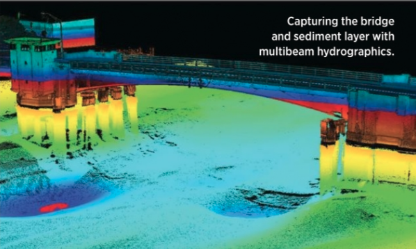
How many times have you read about mapping below the water line? While the TRIDAR system is a LIDAR based system, the modular system allows for multi-beam sonar to replace the Lidar and keep mapping. Now with Triad Drones system, you could map the bridge, the land around it, you could map below the bridge, then map below the water…
The bridge is spanning a particular depth of water. That channel is a critical aspect of the bridge construction. Triad drones has manufactured sea bearing vessels to hydrographically map below the waterline. Offering a solution to map the bridge, the land and the sea below.
Autonomous boats make measuring water depth much easier. They can even visualize the waterways below the bridge. Triad drones recreated what could be seen, and what couldn’t be seen. The 3d model included the bridge, the land and the sea. Triad designed, built and used unmanned boats to carry various sensors to map below the water line. Now those boats can carry TRIDAR.
You might be surprised to learn what sparked Triad drones passion for mapping water with unmanned boats…
Fear of alligators.


Add Your Comment